IONA


Location

lon / lat [deg]: 12.06 / -16.212

Source network: ALBEDOVAL2


Geostationary surface albedo (GSA) data


“+000”


“+057/+063”


Landcover information (based on ESA CCI landcover data)


Landcover fractions @ 2km distance


Landcover fractions @ 20 km distance


Legend


Distance to open water bodies [km]:

26.5

Distance to urban areas [km]:

none in region


Radius: 1 km

Number of landcover classes:

1

Dominant landcover type:

200: bare areas

Fraction of dominant landcover type [%]:

100.0


Radius: 2 km

Number of landcover classes:

1

Dominant landcover type:

200: bare areas

Fraction of dominant landcover type [%]:

100.0


Radius: 5 km

Number of landcover classes:

1

Dominant landcover type:

200: bare areas

Fraction of dominant landcover type [%]:

100.0


Radius: 10 km

Number of landcover classes:

1

Dominant landcover type:

200: bare areas

Fraction of dominant landcover type [%]:

100.0


Radius: 20 km

Number of landcover classes:

2

Dominant landcover type:

200: bare areas

Fraction of dominant landcover type [%]:

98.0


Disturbances


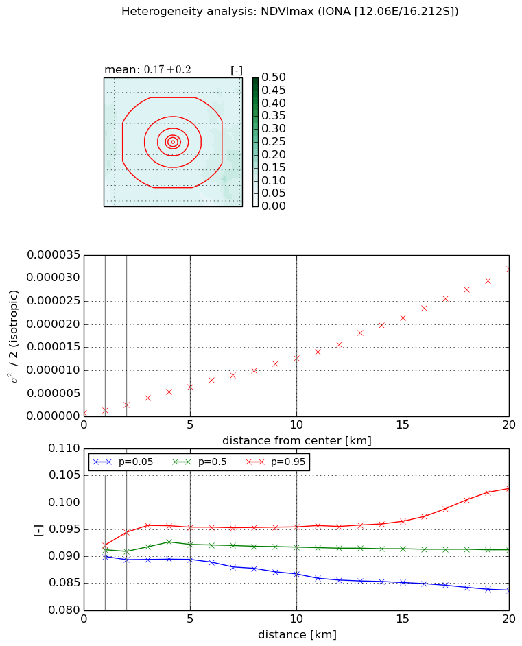
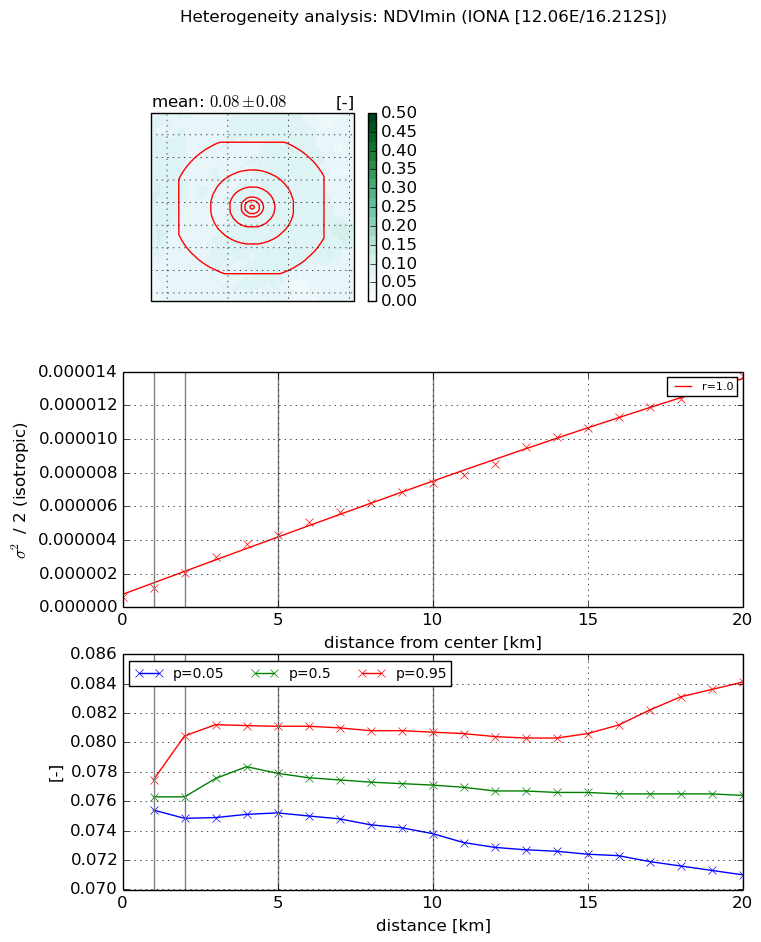
Heterogeneity analysis

The heterogeneity analysis provides information about the spatial and temporal heterogeneity of the site.

Topography


Roman et al. (2009) index


St

0.00499251393399

Rcv

0.484143870429

Rse

0.0

Rst

3.19377759383e-05

Rsv

600.415499119


Height range @ 1km [m]

15

Height range @ 2km [m]

20

Height range @ 5km [m]

36

Height range @ 10km [m]

-999

Height range @ 20km [m]

-999


Variance slope @ 1 km

11

Variance slope @ 2 km

12

Variance slope @ 5 km

23

Variance slope @ 10 km

-999

Variance slope @ 20 km

-999


NDVI (max. NDVI composite)


Roman et al. (2009) index


St

4.37608233212

Rcv

-0.106755069137

Rse

0.0

Rst

0.255903670278

Rsv

-0.322885949263


NDVI range @ 1km [-]

0.0

NDVI range @ 2km [-]

0.01

NDVI range @ 5km [-]

0.01

NDVI range @ 10km [-]

0.01

NDVI range @ 20km [-]

0.02


Variance slope @ 1 km

6.81578942525e-07

Variance slope @ 2 km

9.40923316633e-07

Variance slope @ 5 km

1.18069499908e-06

Variance slope @ 10 km

1.22364137461e-06

Variance slope @ 20 km

1.54402303494e-06


NDVI (min. NDVI composite)I


Roman et al. (2009) index


St

8.61757343252

Rcv

-0.141371346974

Rse

0.0

Rst

0.0200969682724

Rsv

-0.186657525919


NDVI range @ 1km [-]

0.0

NDVI range @ 2km [-]

0.01

NDVI range @ 5km [-]

0.01

NDVI range @ 10km [-]

0.01

NDVI range @ 20km [-]

0.01


NDVI slope @ 1 km

5.3604216234e-07

NDVI slope @ 2 km

7.12859603545e-07

NDVI slope @ 5 km

7.68289248608e-07

NDVI slope @ 10 km

6.87504936729e-07

NDVI slope @ 20 km

6.45533079033e-07


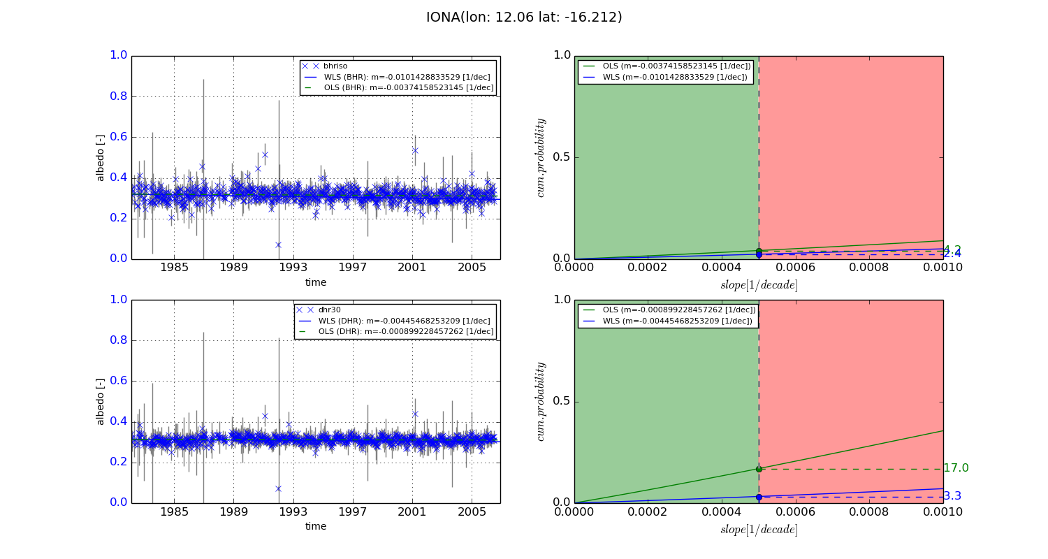
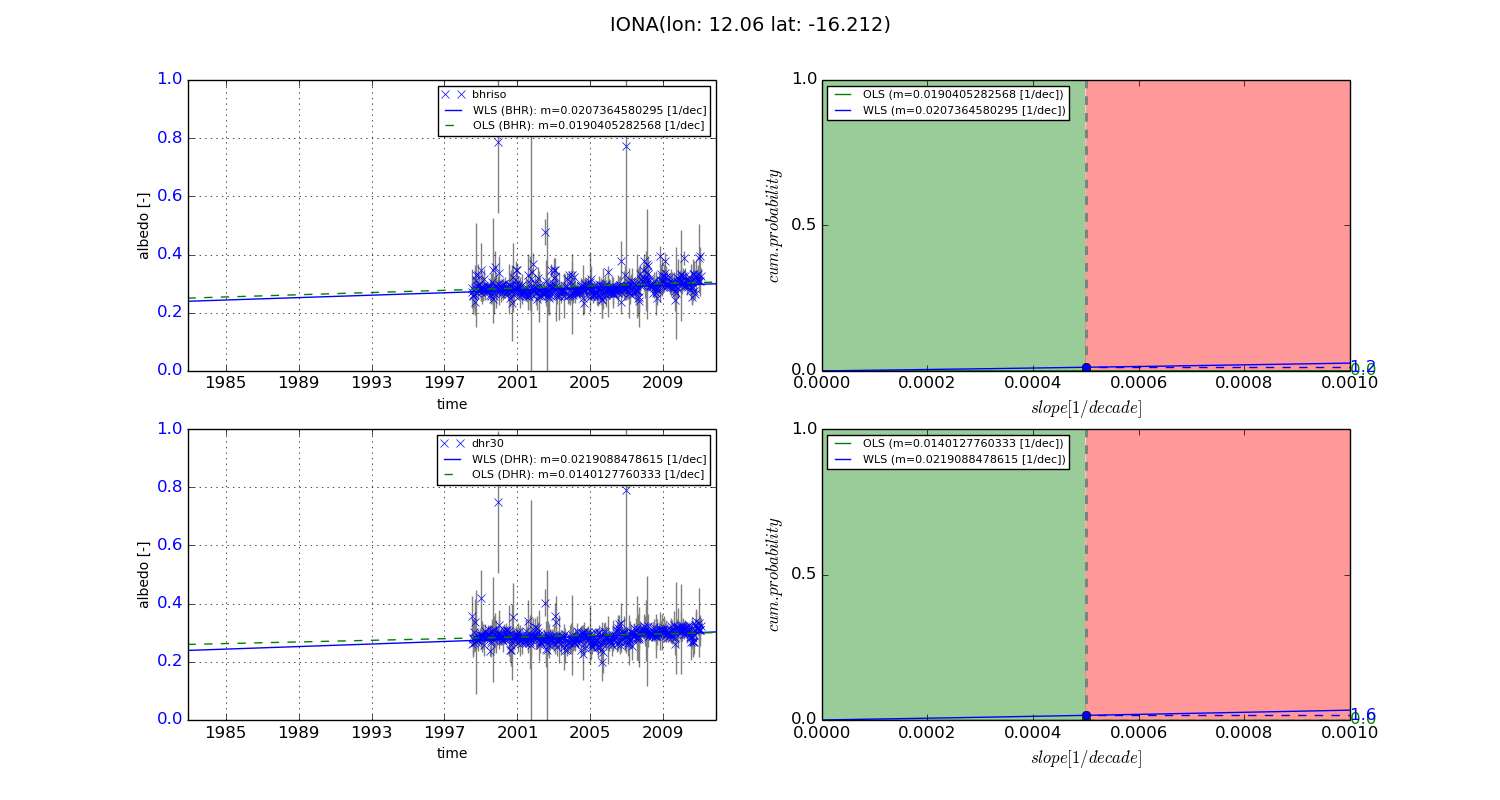
Temporal stability analysis

+000 deg (BHR)


BHR statistics

Temporal stability [1/decade]:


abs

rel


Weighted least square:

-0.0101428833529


Ordinary least square:

-0.00374158523145


Probabilities that GCOS criteria is met:

Weighted least square:

2.4 %

Ordinary least square:

4.2 %


DHR statistics

Temporal stability [1/decade]:


abs

rel


Weighted least square:

-0.00445468253209


Ordinary least square:

-0.000899228457262


Probabilities that GCOS criteria is met:

Weighted least square:

3.3 %

Ordinary least square:

17.0 %


+057/+063 deg (BHR)


BHR statistics

Temporal stability [1/decade]:


abs

rel


Weighted least square:

0.0207364580295


Ordinary least square:

0.0190405282568


Probabilities that GCOS criteria is met:

Weighted least square:

1.2 %

Ordinary least square:

0.0 %


DHR statistics

Temporal stability [1/decade]:


abs

rel


Weighted least square:

0.0219088478615


Ordinary least square:

0.0140127760333


Probabilities that GCOS criteria is met:

Weighted least square:

1.6 %

Ordinary least square:

0.0 %


Temporal anomaly analyis

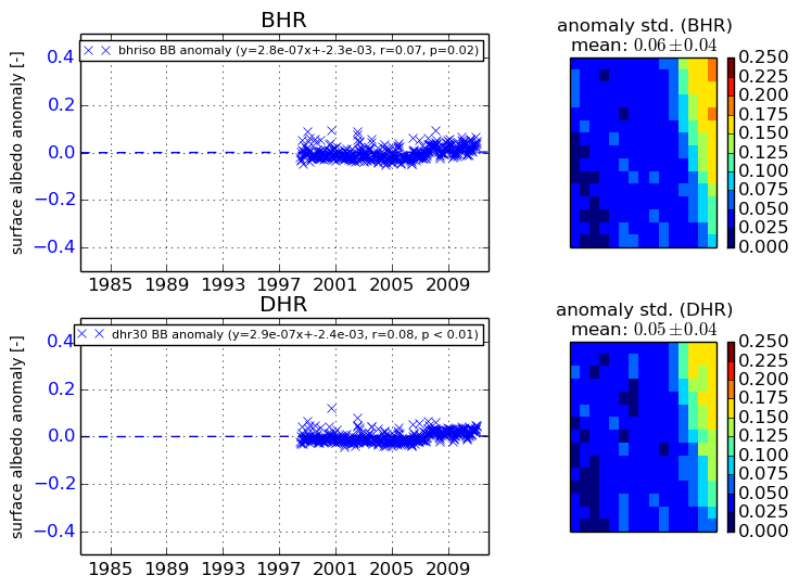
The variance of the temporal anomalies provides an additional measure about the stability of the signal AFTER removal of the mean seasonal cylce.
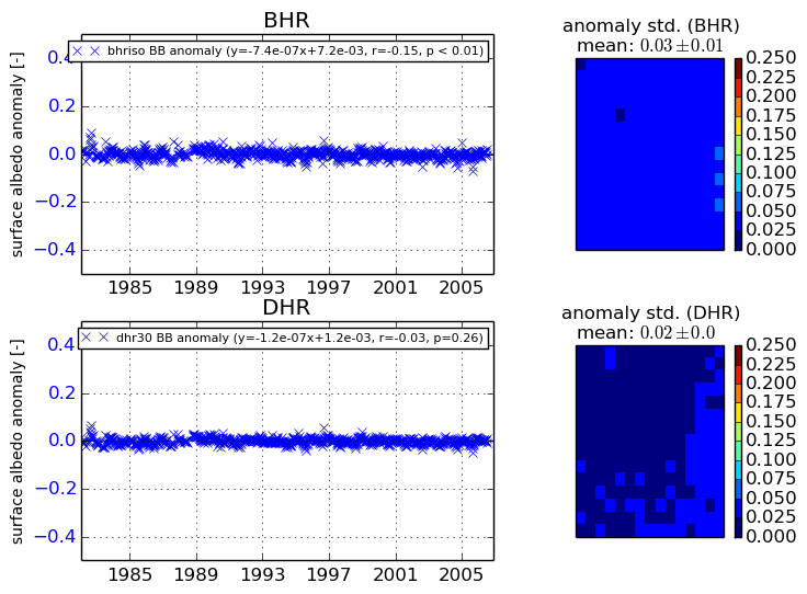
+000 deg


+057/+063 deg