BELMANIP_00165


Location

lon / lat [deg]: 31.1795 / 5.9802

Source network: BELMANIP


Geostationary surface albedo (GSA) data


“+000”


“+057/+063”


Landcover information (based on ESA CCI landcover data)


Landcover fractions @ 2km distance


Landcover fractions @ 20 km distance


Legend


Distance to open water bodies [km]:

21.22

Distance to urban areas [km]:

none in region


Radius: 1 km

Number of landcover classes:

1

Dominant landcover type:

120: Shrubland

Fraction of dominant landcover type [%]:

100.0


Radius: 2 km

Number of landcover classes:

1

Dominant landcover type:

120: Shrubland

Fraction of dominant landcover type [%]:

100.0


Radius: 5 km

Number of landcover classes:

1

Dominant landcover type:

120: Shrubland

Fraction of dominant landcover type [%]:

100.0


Radius: 10 km

Number of landcover classes:

2

Dominant landcover type:

120: Shrubland

Fraction of dominant landcover type [%]:

96.0


Radius: 20 km

Number of landcover classes:

2

Dominant landcover type:

120: Shrubland

Fraction of dominant landcover type [%]:

91.0


Disturbances


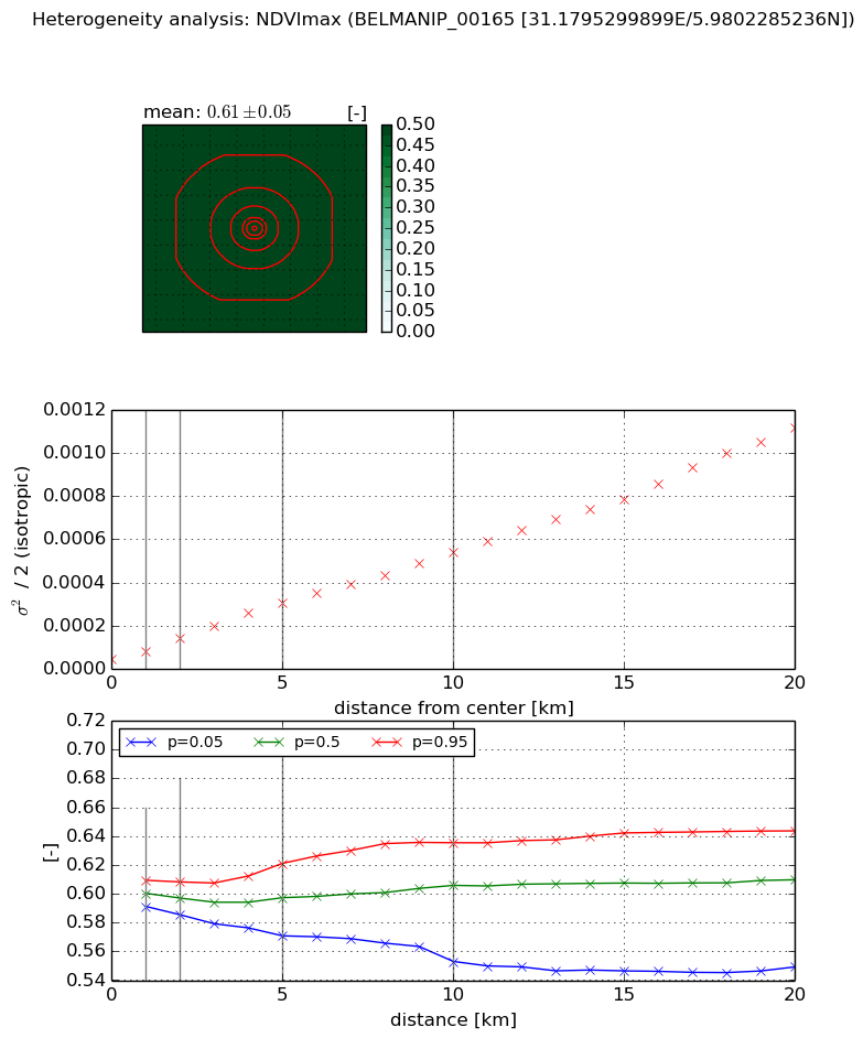
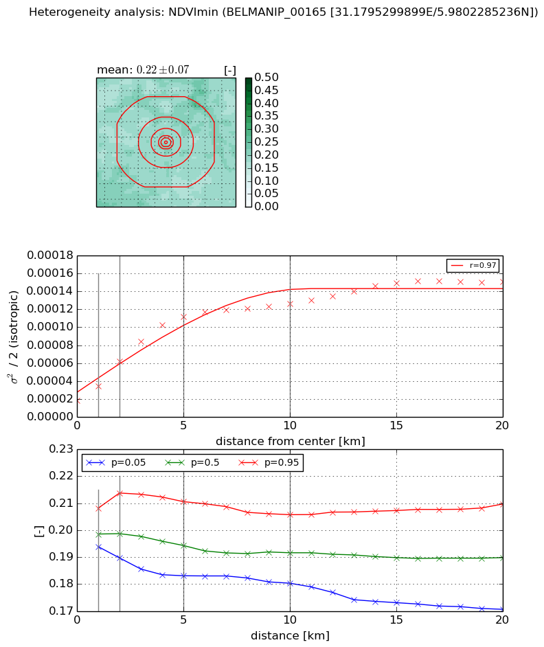
Heterogeneity analysis

The heterogeneity analysis provides information about the spatial and temporal heterogeneity of the site.

Topography


Roman et al. (2009) index


St

2.50050169648

Rcv

0.198654913973

Rse

0.0

Rst

0.00110499009242

Rsv

-0.999999329939


Height range @ 1km [m]

4

Height range @ 2km [m]

5

Height range @ 5km [m]

6

Height range @ 10km [m]

-999

Height range @ 20km [m]

-999


Variance slope @ 1 km

0

Variance slope @ 2 km

0

Variance slope @ 5 km

0

Variance slope @ 10 km

-999

Variance slope @ 20 km

-999


NDVI (max. NDVI composite)


Roman et al. (2009) index


St

nan

Rcv

nan

Rse

nan

Rst

nan

Rsv

nan


NDVI range @ 1km [-]

0.02

NDVI range @ 2km [-]

0.02

NDVI range @ 5km [-]

0.05

NDVI range @ 10km [-]

0.08

NDVI range @ 20km [-]

0.09


Variance slope @ 1 km

3.45122346849e-05

Variance slope @ 2 km

4.8182814825e-05

Variance slope @ 5 km

5.44190184576e-05

Variance slope @ 10 km

4.95099596812e-05

Variance slope @ 20 km

5.24577178559e-05


NDVI (min. NDVI composite)I


Roman et al. (2009) index


St

13.1758718196

Rcv

-0.0895057571809

Rse

0.0

Rst

0.0105858925927

Rsv

-0.127597268354


NDVI range @ 1km [-]

0.01

NDVI range @ 2km [-]

0.02

NDVI range @ 5km [-]

0.03

NDVI range @ 10km [-]

0.03

NDVI range @ 20km [-]

0.04


NDVI slope @ 1 km

1.63086792919e-05

NDVI slope @ 2 km

2.18321577137e-05

NDVI slope @ 5 km

1.98301379731e-05

NDVI slope @ 10 km

1.04771935834e-05

NDVI slope @ 20 km

5.50054124768e-06


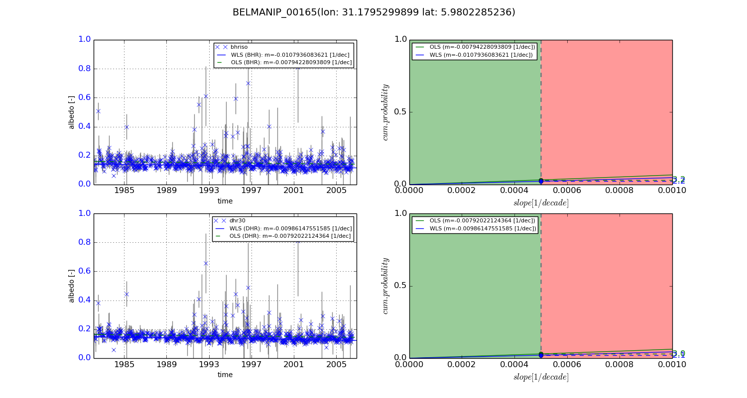
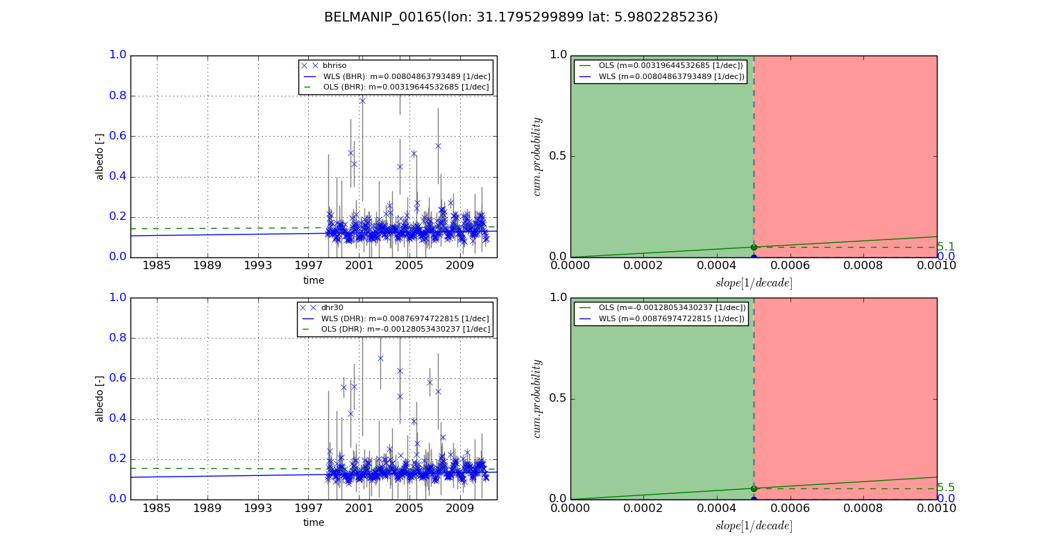
Temporal stability analysis

+000 deg (BHR)


BHR statistics

Temporal stability [1/decade]:


abs

rel


Weighted least square:

-0.0107936083621


Ordinary least square:

-0.00794228093809


Probabilities that GCOS criteria is met:

Weighted least square:

2.2 %

Ordinary least square:

3.2 %


DHR statistics

Temporal stability [1/decade]:


abs

rel


Weighted least square:

-0.00986147551585


Ordinary least square:

-0.00792022124364


Probabilities that GCOS criteria is met:

Weighted least square:

2.1 %

Ordinary least square:

3.0 %


+057/+063 deg (BHR)


BHR statistics

Temporal stability [1/decade]:


abs

rel


Weighted least square:

0.00804863793489


Ordinary least square:

0.00319644532685


Probabilities that GCOS criteria is met:

Weighted least square:

0.0 %

Ordinary least square:

5.1 %


DHR statistics

Temporal stability [1/decade]:


abs

rel


Weighted least square:

0.00876974722815


Ordinary least square:

-0.00128053430237


Probabilities that GCOS criteria is met:

Weighted least square:

0.0 %

Ordinary least square:

5.5 %


Temporal anomaly analyis

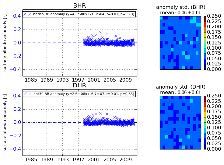
The variance of the temporal anomalies provides an additional measure about the stability of the signal AFTER removal of the mean seasonal cylce.
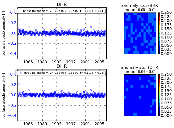
+000 deg


+057/+063 deg