BELMANIP_00199


Location

lon / lat [deg]: 50.0526 / 10.5147

Source network: BELMANIP


Geostationary surface albedo (GSA) data


“+000”


“+057/+063”


Landcover information (based on ESA CCI landcover data)


Landcover fractions @ 2km distance


Landcover fractions @ 20 km distance


Legend


Distance to open water bodies [km]:

none in region

Distance to urban areas [km]:

none in region


Radius: 1 km

Number of landcover classes:

1

Dominant landcover type:

200: bare areas

Fraction of dominant landcover type [%]:

100.0


Radius: 2 km

Number of landcover classes:

2

Dominant landcover type:

200: bare areas

Fraction of dominant landcover type [%]:

97.0


Radius: 5 km

Number of landcover classes:

3

Dominant landcover type:

200: bare areas

Fraction of dominant landcover type [%]:

83.0


Radius: 10 km

Number of landcover classes:

4

Dominant landcover type:

200: bare areas

Fraction of dominant landcover type [%]:

65.0


Radius: 20 km

Number of landcover classes:

3

Dominant landcover type:

200: bare areas

Fraction of dominant landcover type [%]:

59.0


Disturbances


Heterogeneity analysis

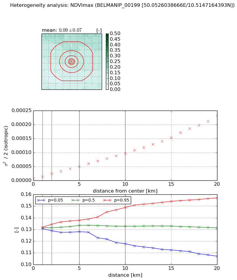
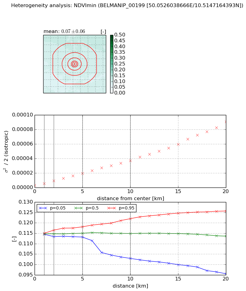
The heterogeneity analysis provides information about the spatial and temporal heterogeneity of the site.

Topography


Roman et al. (2009) index


St

1.61685924977

Rcv

0.819388365912

Rse

0.0

Rst

8.78791341833e-09

Rsv

1.03606070068


Height range @ 1km [m]

11

Height range @ 2km [m]

20

Height range @ 5km [m]

58

Height range @ 10km [m]

-999

Height range @ 20km [m]

-999


Variance slope @ 1 km

15

Variance slope @ 2 km

30

Variance slope @ 5 km

67

Variance slope @ 10 km

-999

Variance slope @ 20 km

-999


NDVI (max. NDVI composite)


Roman et al. (2009) index


St

6.27052696471e-06

Rcv

0.0947948732059

Rse

0.0

Rst

0.298569636084

Rsv

478428.296423


NDVI range @ 1km [-]

0.0

NDVI range @ 2km [-]

0.01

NDVI range @ 5km [-]

0.01

NDVI range @ 10km [-]

0.03

NDVI range @ 20km [-]

0.05


Variance slope @ 1 km

6.39420433218e-06

Variance slope @ 2 km

8.19675966176e-06

Variance slope @ 5 km

8.70268734134e-06

Variance slope @ 10 km

9.04909945494e-06

Variance slope @ 20 km

1.08532318417e-05


NDVI (min. NDVI composite)I


Roman et al. (2009) index


St

1.93682420468e-07

Rcv

0.295209922585

Rse

0.0

Rst

0.265417634616

Rsv

15489273.0283


NDVI range @ 1km [-]

0.0

NDVI range @ 2km [-]

0.0

NDVI range @ 5km [-]

0.0

NDVI range @ 10km [-]

0.02

NDVI range @ 20km [-]

0.03


NDVI slope @ 1 km

2.46988772053e-06

NDVI slope @ 2 km

3.17719310984e-06

NDVI slope @ 5 km

3.36013136781e-06

NDVI slope @ 10 km

3.47627830858e-06

NDVI slope @ 20 km

4.23448579414e-06


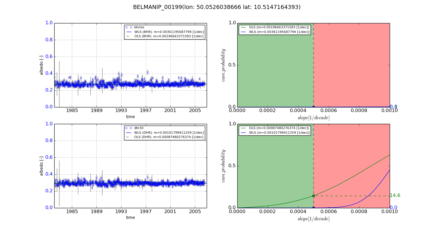
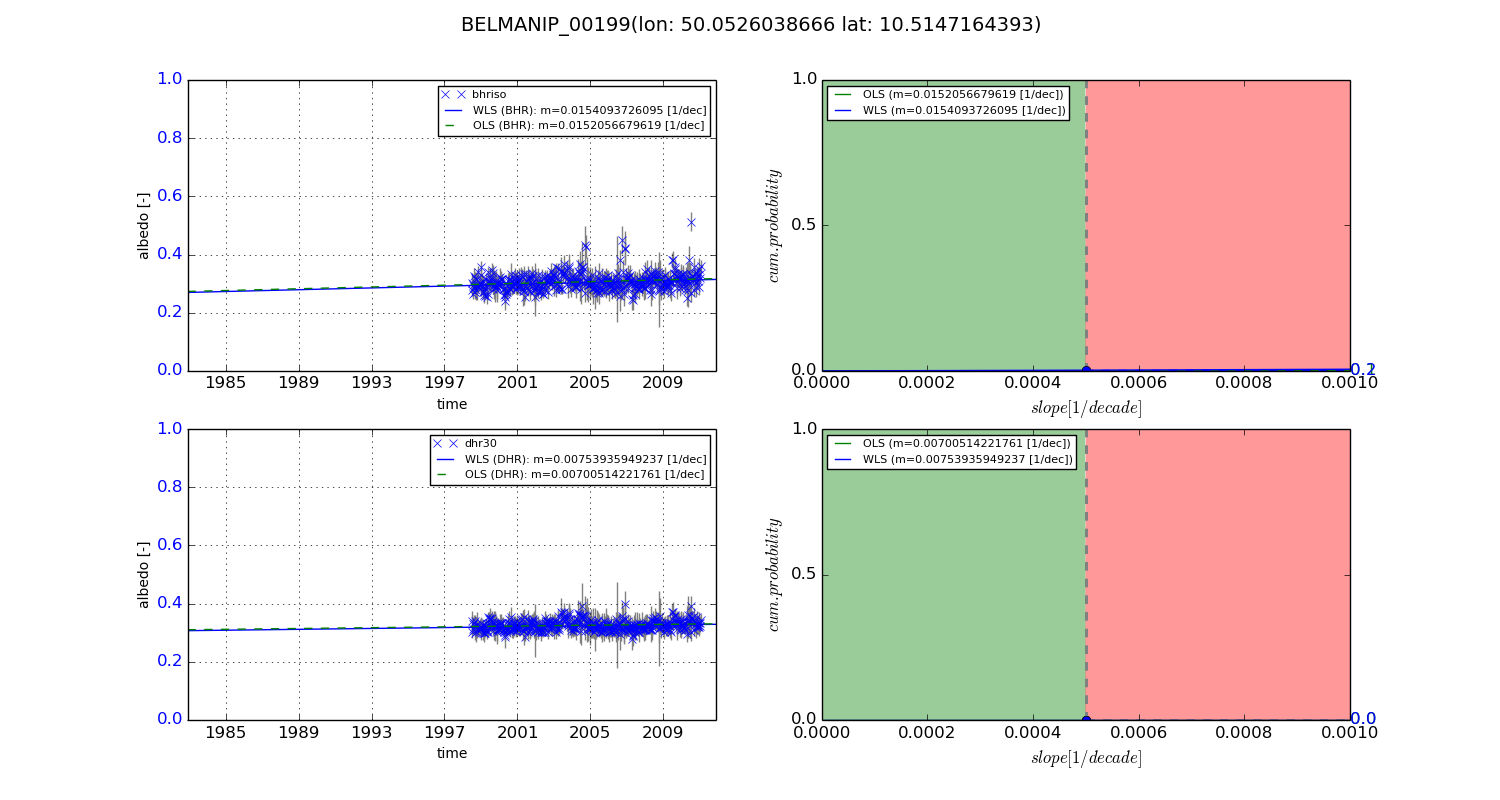
Temporal stability analysis

+000 deg (BHR)


BHR statistics

Temporal stability [1/decade]:


abs

rel


Weighted least square:

0.00361195687794


Ordinary least square:

0.00196663371583


Probabilities that GCOS criteria is met:

Weighted least square:

0.1 %

Ordinary least square:

0.0 %


DHR statistics

Temporal stability [1/decade]:


abs

rel


Weighted least square:

0.00101799411259


Ordinary least square:

0.00087480276374


Probabilities that GCOS criteria is met:

Weighted least square:

0.0 %

Ordinary least square:

14.6 %


+057/+063 deg (BHR)


BHR statistics

Temporal stability [1/decade]:


abs

rel


Weighted least square:

0.0154093726095


Ordinary least square:

0.0152056679619


Probabilities that GCOS criteria is met:

Weighted least square:

0.2 %

Ordinary least square:

0.1 %


DHR statistics

Temporal stability [1/decade]:


abs

rel


Weighted least square:

0.00753935949237


Ordinary least square:

0.00700514221761


Probabilities that GCOS criteria is met:

Weighted least square:

0.0 %

Ordinary least square:

0.0 %


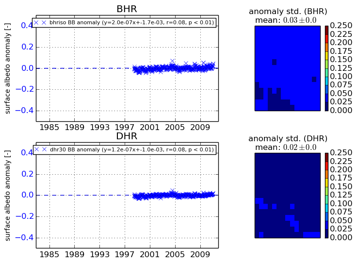
Temporal anomaly analyis

The variance of the temporal anomalies provides an additional measure about the stability of the signal AFTER removal of the mean seasonal cylce.
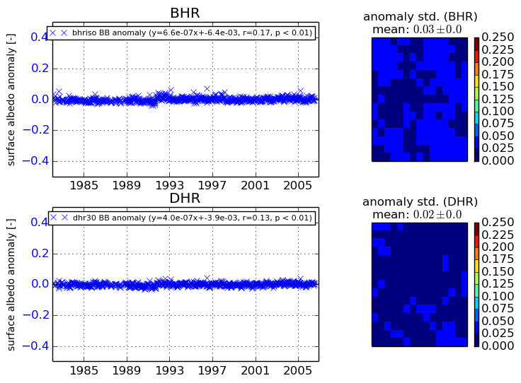
+000 deg


+057/+063 deg