BELMANIP_00241


Location

lon / lat [deg]: 58.8439 / 39.5513

Source network: BELMANIP


Geostationary surface albedo (GSA) data


“+000”


“+057/+063”


Landcover information (based on ESA CCI landcover data)


Landcover fractions @ 2km distance


Landcover fractions @ 20 km distance


Legend


Distance to open water bodies [km]:

47.94

Distance to urban areas [km]:

none in region


Radius: 1 km

Number of landcover classes:

1

Dominant landcover type:

200: bare areas

Fraction of dominant landcover type [%]:

100.0


Radius: 2 km

Number of landcover classes:

1

Dominant landcover type:

200: bare areas

Fraction of dominant landcover type [%]:

100.0


Radius: 5 km

Number of landcover classes:

1

Dominant landcover type:

200: bare areas

Fraction of dominant landcover type [%]:

100.0


Radius: 10 km

Number of landcover classes:

1

Dominant landcover type:

200: bare areas

Fraction of dominant landcover type [%]:

100.0


Radius: 20 km

Number of landcover classes:

1

Dominant landcover type:

200: bare areas

Fraction of dominant landcover type [%]:

100.0


Disturbances


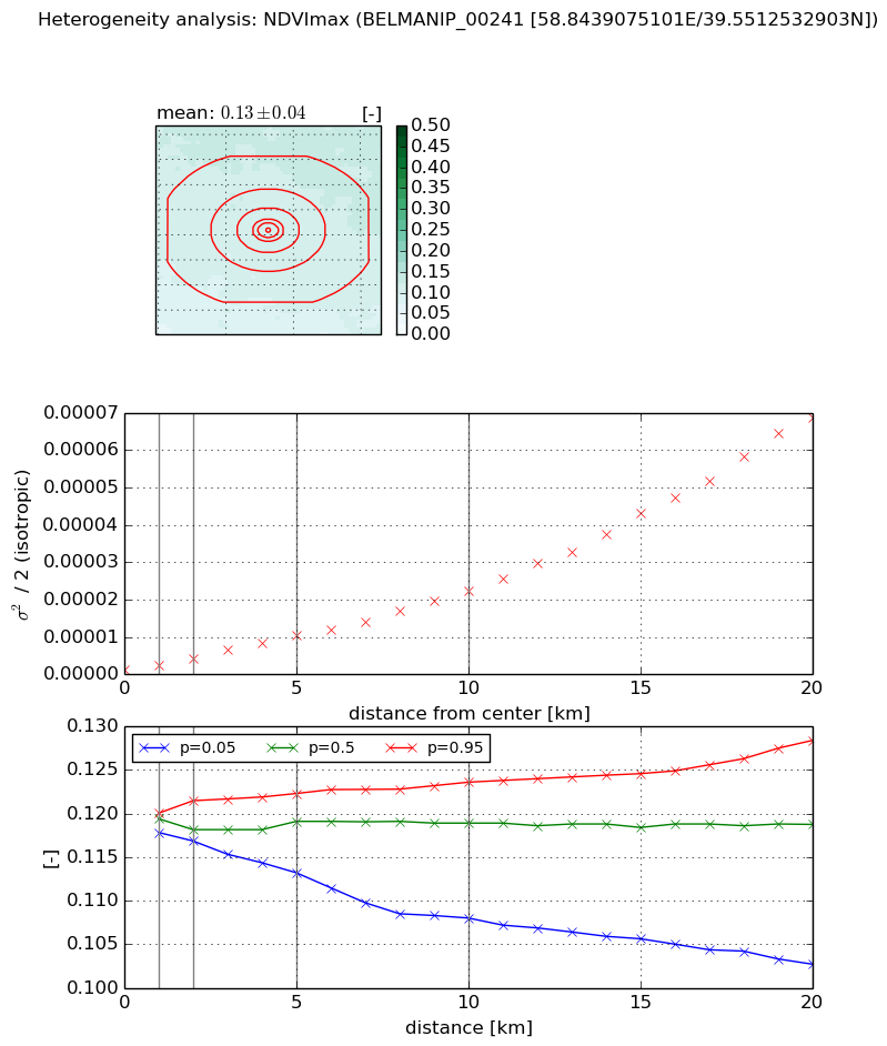
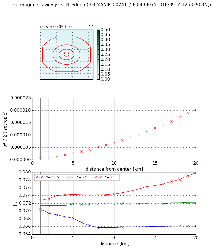
Heterogeneity analysis

The heterogeneity analysis provides information about the spatial and temporal heterogeneity of the site.

Topography


Roman et al. (2009) index


St

23.603100511

Rcv

0.0847464195848

Rse

0.0

Rst

-0.00591691132148

Rsv

-0.0364386148149


Height range @ 1km [m]

6

Height range @ 2km [m]

6

Height range @ 5km [m]

7

Height range @ 10km [m]

-999

Height range @ 20km [m]

-999


Variance slope @ 1 km

4

Variance slope @ 2 km

1

Variance slope @ 5 km

0

Variance slope @ 10 km

-999

Variance slope @ 20 km

-999


NDVI (max. NDVI composite)


Roman et al. (2009) index


St

1.8964970676

Rcv

0.607207108047

Rse

0.0

Rst

-8.21795626205e-07

Rsv

-0.974655839555


NDVI range @ 1km [-]

0.0

NDVI range @ 2km [-]

0.0

NDVI range @ 5km [-]

0.01

NDVI range @ 10km [-]

0.02

NDVI range @ 20km [-]

0.03


Variance slope @ 1 km

1.35976610016e-06

Variance slope @ 2 km

1.55676137318e-06

Variance slope @ 5 km

1.90288473386e-06

Variance slope @ 10 km

2.10757205552e-06

Variance slope @ 20 km

3.33905847492e-06


NDVI (min. NDVI composite)I


Roman et al. (2009) index


St

9.36821974644

Rcv

0.241902803678

Rse

0.0

Rst

-2.8097926088e-08

Rsv

-0.0783287683789


NDVI range @ 1km [-]

0.0

NDVI range @ 2km [-]

0.0

NDVI range @ 5km [-]

0.01

NDVI range @ 10km [-]

0.01

NDVI range @ 20km [-]

0.01


NDVI slope @ 1 km

2.80076903425e-07

NDVI slope @ 2 km

3.30594141326e-07

NDVI slope @ 5 km

4.98910743756e-07

NDVI slope @ 10 km

6.79400005999e-07

NDVI slope @ 20 km

1.01002407044e-06


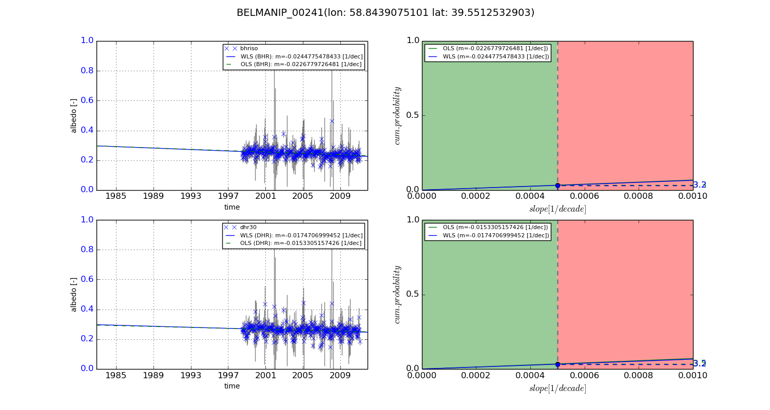
Temporal stability analysis

+000 deg (BHR)


BHR statistics

Temporal stability [1/decade]:


abs

rel


Weighted least square:

-99999.0


Ordinary least square:

-99999.0


Probabilities that GCOS criteria is met:

Weighted least square:

-99999.0 %

Ordinary least square:

-99999.0 %


DHR statistics

Temporal stability [1/decade]:


abs

rel


Weighted least square:

-99999.0


Ordinary least square:

-99999.0


Probabilities that GCOS criteria is met:

Weighted least square:

-99999.0 %

Ordinary least square:

-99999.0 %


+057/+063 deg (BHR)


BHR statistics

Temporal stability [1/decade]:


abs

rel


Weighted least square:

-0.0244775478433


Ordinary least square:

-0.0226779726481


Probabilities that GCOS criteria is met:

Weighted least square:

3.2 %

Ordinary least square:

3.3 %


DHR statistics

Temporal stability [1/decade]:


abs

rel


Weighted least square:

-0.0174706999452


Ordinary least square:

-0.0153305157426


Probabilities that GCOS criteria is met:

Weighted least square:

3.2 %

Ordinary least square:

3.5 %


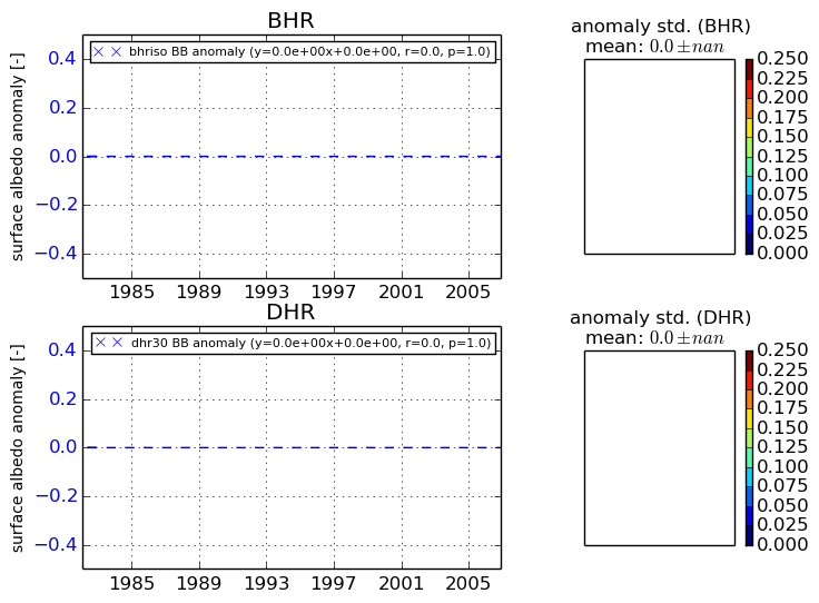
Temporal anomaly analyis

The variance of the temporal anomalies provides an additional measure about the stability of the signal AFTER removal of the mean seasonal cylce.
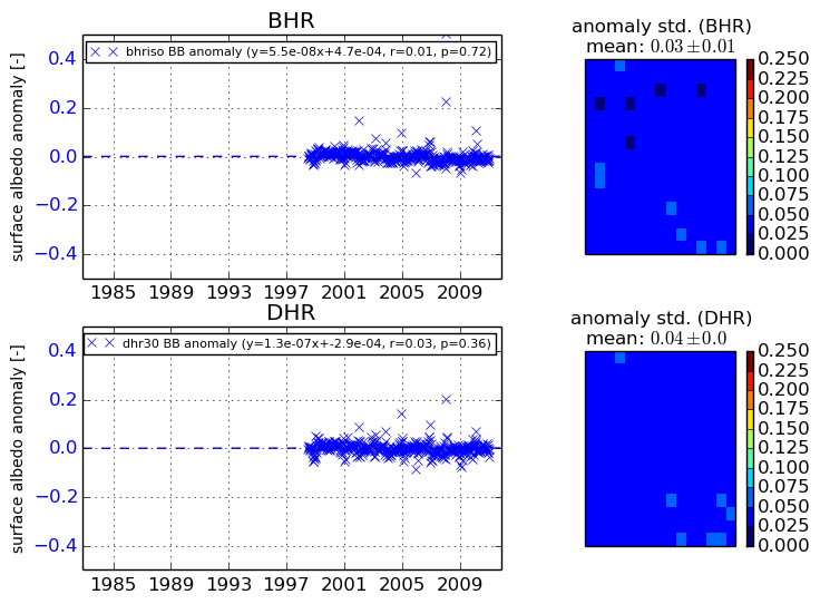
+000 deg


+057/+063 deg