BELMANIP_00329


Location

lon / lat [deg]: 70.0356 / 26.9862

Source network: BELMANIP


Geostationary surface albedo (GSA) data


“+000”


“+057/+063”


Landcover information (based on ESA CCI landcover data)


Landcover fractions @ 2km distance


Landcover fractions @ 20 km distance


Legend


Distance to open water bodies [km]:

none in region

Distance to urban areas [km]:

63.46


Radius: 1 km

Number of landcover classes:

1

Dominant landcover type:

122: Shrubland

Fraction of dominant landcover type [%]:

100.0


Radius: 2 km

Number of landcover classes:

1

Dominant landcover type:

122: Shrubland

Fraction of dominant landcover type [%]:

100.0


Radius: 5 km

Number of landcover classes:

1

Dominant landcover type:

122: Shrubland

Fraction of dominant landcover type [%]:

100.0


Radius: 10 km

Number of landcover classes:

1

Dominant landcover type:

122: Shrubland

Fraction of dominant landcover type [%]:

100.0


Radius: 20 km

Number of landcover classes:

2

Dominant landcover type:

122: Shrubland

Fraction of dominant landcover type [%]:

91.0


Disturbances


Heterogeneity analysis

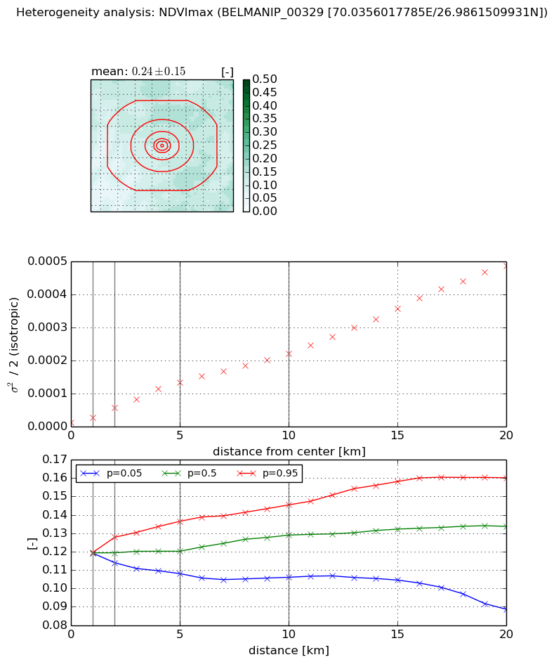
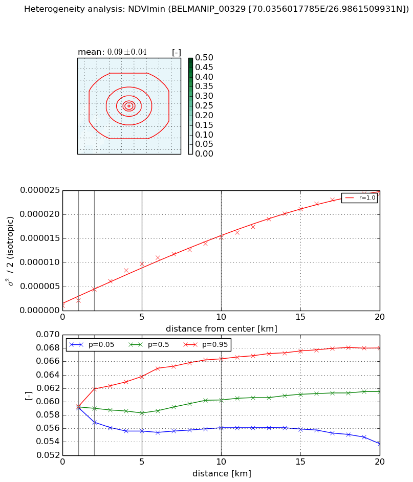
The heterogeneity analysis provides information about the spatial and temporal heterogeneity of the site.

Topography


Roman et al. (2009) index


St

2.60088942848

Rcv

0.124579376589

Rse

0.0

Rst

0.0288818155483

Rsv

-0.999990379908


Height range @ 1km [m]

17

Height range @ 2km [m]

22

Height range @ 5km [m]

26

Height range @ 10km [m]

-999

Height range @ 20km [m]

-999


Variance slope @ 1 km

24

Variance slope @ 2 km

15

Variance slope @ 5 km

9

Variance slope @ 10 km

-999

Variance slope @ 20 km

-999


NDVI (max. NDVI composite)


Roman et al. (2009) index


St

2.10921457479e-06

Rcv

0.366378446326

Rse

0.0

Rst

0.29383048615

Rsv

1422329.73512


NDVI range @ 1km [-]

0.0

NDVI range @ 2km [-]

0.01

NDVI range @ 5km [-]

0.03

NDVI range @ 10km [-]

0.04

NDVI range @ 20km [-]

0.07


Variance slope @ 1 km

1.40278000714e-05

Variance slope @ 2 km

2.23528279928e-05

Variance slope @ 5 km

2.53207141305e-05

Variance slope @ 10 km

2.11640090034e-05

Variance slope @ 20 km

2.35546368072e-05


NDVI (min. NDVI composite)I


Roman et al. (2009) index


St

1.50658305435e-11

Rcv

0.360962920412

Rse

0.0

Rst

0.221388397469

Rsv

1.99126094731e+11


NDVI range @ 1km [-]

0.0

NDVI range @ 2km [-]

0.0

NDVI range @ 5km [-]

0.01

NDVI range @ 10km [-]

0.01

NDVI range @ 20km [-]

0.01


NDVI slope @ 1 km

1.0664334571e-06

NDVI slope @ 2 km

1.675160918e-06

NDVI slope @ 5 km

1.8412298251e-06

NDVI slope @ 10 km

1.42201884141e-06

NDVI slope @ 20 km

1.18958766046e-06


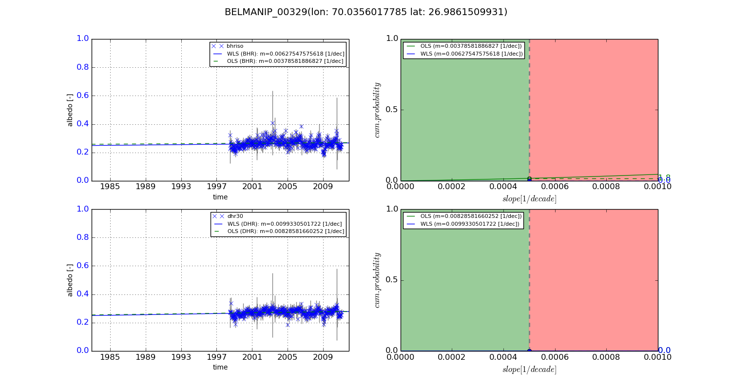
Temporal stability analysis

+000 deg (BHR)


BHR statistics

Temporal stability [1/decade]:


abs

rel


Weighted least square:

-99999.0


Ordinary least square:

-99999.0


Probabilities that GCOS criteria is met:

Weighted least square:

-99999.0 %

Ordinary least square:

-99999.0 %


DHR statistics

Temporal stability [1/decade]:


abs

rel


Weighted least square:

-99999.0


Ordinary least square:

-99999.0


Probabilities that GCOS criteria is met:

Weighted least square:

-99999.0 %

Ordinary least square:

-99999.0 %


+057/+063 deg (BHR)


BHR statistics

Temporal stability [1/decade]:


abs

rel


Weighted least square:

0.00627547575618


Ordinary least square:

0.00378581886827


Probabilities that GCOS criteria is met:

Weighted least square:

0.0 %

Ordinary least square:

1.8 %


DHR statistics

Temporal stability [1/decade]:


abs

rel


Weighted least square:

0.0099330501722


Ordinary least square:

0.00828581660252


Probabilities that GCOS criteria is met:

Weighted least square:

0.0 %

Ordinary least square:

0.0 %


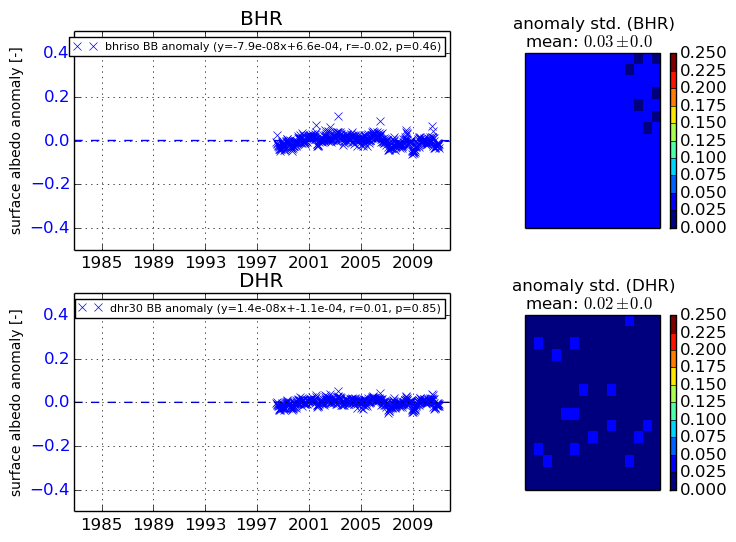
Temporal anomaly analyis

The variance of the temporal anomalies provides an additional measure about the stability of the signal AFTER removal of the mean seasonal cylce.

+000 deg


+057/+063 deg