BELMANIP_00345


Location

lon / lat [deg]: 66.7087 / 34.4713

Source network: BELMANIP


Geostationary surface albedo (GSA) data


“+000”


“+057/+063”


Landcover information (based on ESA CCI landcover data)


Landcover fractions @ 2km distance


Landcover fractions @ 20 km distance


Legend


Distance to open water bodies [km]:

22.87

Distance to urban areas [km]:

25.9


Radius: 1 km

Number of landcover classes:

5

Dominant landcover type:

130: grassland

Fraction of dominant landcover type [%]:

62.0


Radius: 2 km

Number of landcover classes:

5

Dominant landcover type:

130: grassland

Fraction of dominant landcover type [%]:

52.0


Radius: 5 km

Number of landcover classes:

5

Dominant landcover type:

130: grassland

Fraction of dominant landcover type [%]:

54.0


Radius: 10 km

Number of landcover classes:

6

Dominant landcover type:

130: grassland

Fraction of dominant landcover type [%]:

56.0


Radius: 20 km

Number of landcover classes:

6

Dominant landcover type:

130: grassland

Fraction of dominant landcover type [%]:

65.0


Disturbances


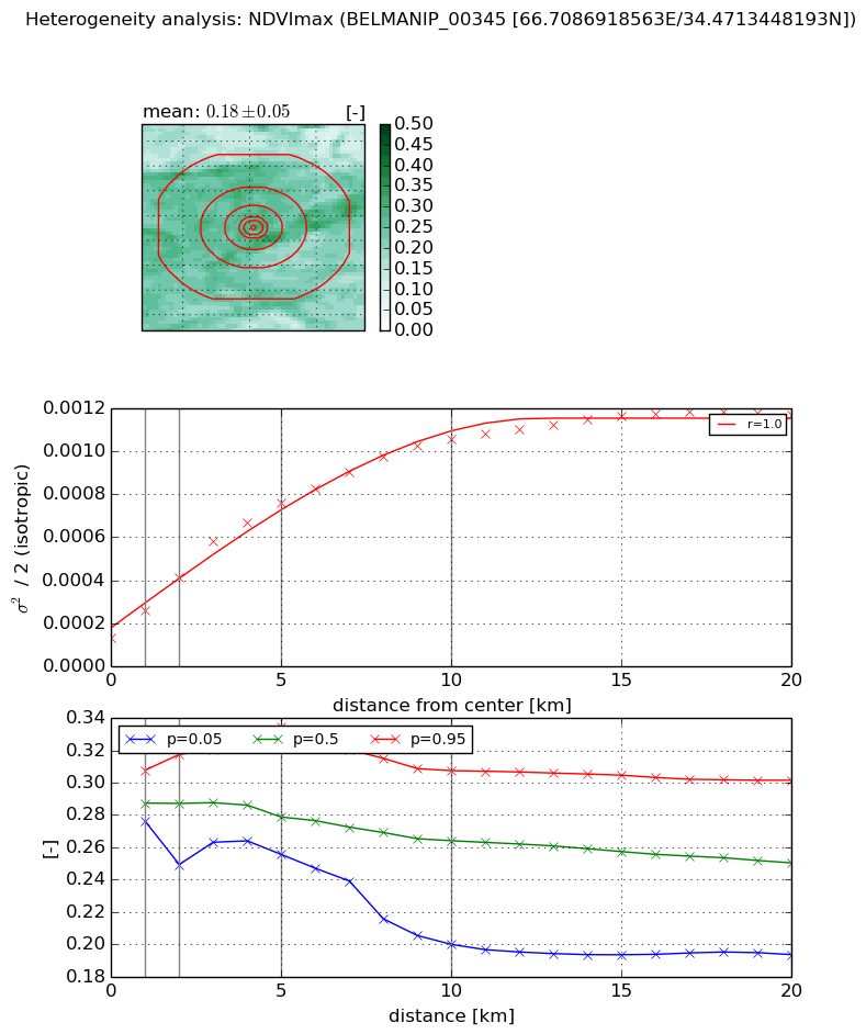
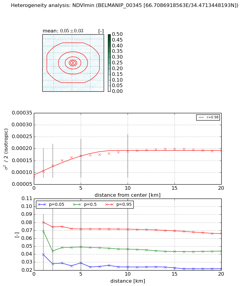
Heterogeneity analysis

The heterogeneity analysis provides information about the spatial and temporal heterogeneity of the site.

Topography


Roman et al. (2009) index


St

3.22660740644

Rcv

0.0522781103348

Rse

0.0

Rst

-0.0744813270269

Rsv

0.803009704682


Height range @ 1km [m]

285

Height range @ 2km [m]

388

Height range @ 5km [m]

451

Height range @ 10km [m]

-999

Height range @ 20km [m]

-999


Variance slope @ 1 km

7412

Variance slope @ 2 km

7416

Variance slope @ 5 km

4626

Variance slope @ 10 km

-999

Variance slope @ 20 km

-999


NDVI (max. NDVI composite)


Roman et al. (2009) index


St

nan

Rcv

nan

Rse

nan

Rst

nan

Rsv

nan


NDVI range @ 1km [-]

0.03

NDVI range @ 2km [-]

0.07

NDVI range @ 5km [-]

0.08

NDVI range @ 10km [-]

0.11

NDVI range @ 20km [-]

0.11


Variance slope @ 1 km

0.000127930844116

Variance slope @ 2 km

0.000140680320809

Variance slope @ 5 km

0.000129157035924

Variance slope @ 10 km

9.20594294814e-05

Variance slope @ 20 km

4.70935193358e-05


NDVI (min. NDVI composite)I


Roman et al. (2009) index


St

3.15743461863

Rcv

-0.088146764739

Rse

0.0

Rst

-0.599791169345

Rsv

-0.262200504984


NDVI range @ 1km [-]

0.04

NDVI range @ 2km [-]

0.05

NDVI range @ 5km [-]

0.04

NDVI range @ 10km [-]

0.05

NDVI range @ 20km [-]

0.04


NDVI slope @ 1 km

2.36790128744e-05

NDVI slope @ 2 km

2.3608820953e-05

NDVI slope @ 5 km

1.82882331352e-05

NDVI slope @ 10 km

9.78024227934e-06

NDVI slope @ 20 km

4.19883270545e-06


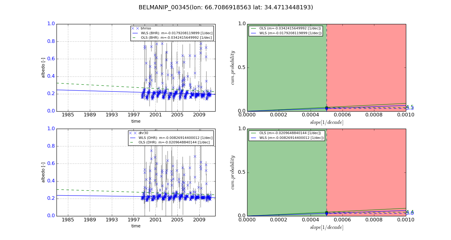
Temporal stability analysis

+000 deg (BHR)


BHR statistics

Temporal stability [1/decade]:


abs

rel


Weighted least square:

-99999.0


Ordinary least square:

-99999.0


Probabilities that GCOS criteria is met:

Weighted least square:

-99999.0 %

Ordinary least square:

-99999.0 %


DHR statistics

Temporal stability [1/decade]:


abs

rel


Weighted least square:

-99999.0


Ordinary least square:

-99999.0


Probabilities that GCOS criteria is met:

Weighted least square:

-99999.0 %

Ordinary least square:

-99999.0 %


+057/+063 deg (BHR)


BHR statistics

Temporal stability [1/decade]:


abs

rel


Weighted least square:

-0.0179208119899


Ordinary least square:

-0.0342415649992


Probabilities that GCOS criteria is met:

Weighted least square:

3.3 %

Ordinary least square:

4.5 %


DHR statistics

Temporal stability [1/decade]:


abs

rel


Weighted least square:

-0.00826914400012


Ordinary least square:

-0.0209648840144


Probabilities that GCOS criteria is met:

Weighted least square:

3.0 %

Ordinary least square:

4.4 %


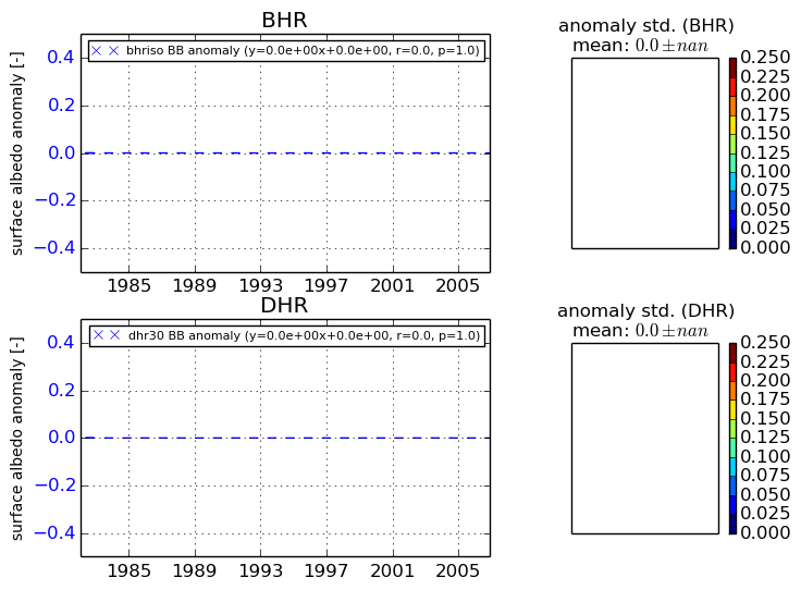
Temporal anomaly analyis

The variance of the temporal anomalies provides an additional measure about the stability of the signal AFTER removal of the mean seasonal cylce.
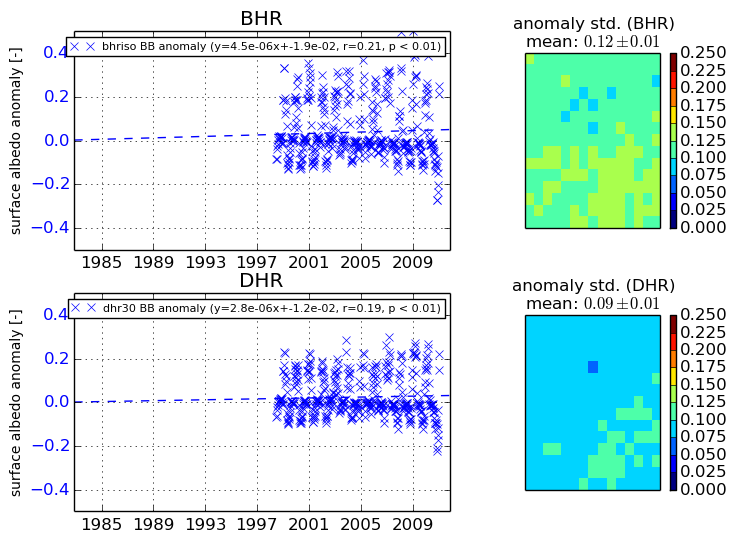
+000 deg


+057/+063 deg


By continuing to use this website, you are giving consent to analytic cookies being used. For more information on how EUMETSAT uses data and how you can disable this, please view this web page: Analytics Cookie Policy