BELMANIP_00358


Location

lon / lat [deg]: 61.063 / 39.7021

Source network: BELMANIP


Geostationary surface albedo (GSA) data


“+000”


“+057/+063”


Landcover information (based on ESA CCI landcover data)


Landcover fractions @ 2km distance


Landcover fractions @ 20 km distance


Legend


Distance to open water bodies [km]:

none in region

Distance to urban areas [km]:

none in region


Radius: 1 km

Number of landcover classes:

1

Dominant landcover type:

200: bare areas

Fraction of dominant landcover type [%]:

100.0


Radius: 2 km

Number of landcover classes:

1

Dominant landcover type:

200: bare areas

Fraction of dominant landcover type [%]:

100.0


Radius: 5 km

Number of landcover classes:

1

Dominant landcover type:

200: bare areas

Fraction of dominant landcover type [%]:

100.0


Radius: 10 km

Number of landcover classes:

1

Dominant landcover type:

200: bare areas

Fraction of dominant landcover type [%]:

100.0


Radius: 20 km

Number of landcover classes:

1

Dominant landcover type:

200: bare areas

Fraction of dominant landcover type [%]:

100.0


Disturbances


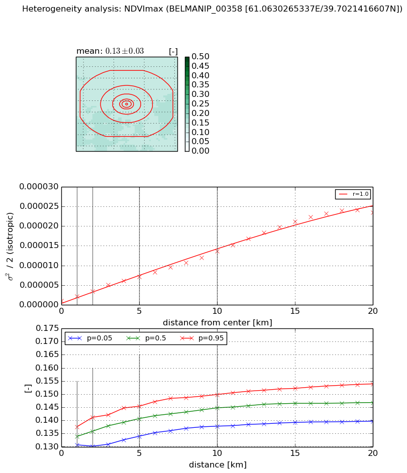
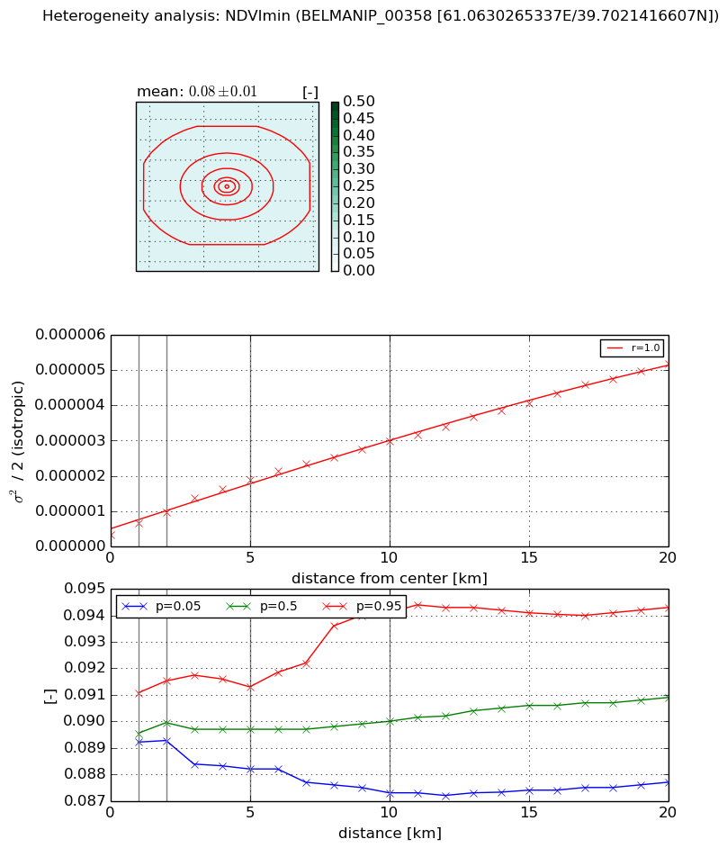
Heterogeneity analysis

The heterogeneity analysis provides information about the spatial and temporal heterogeneity of the site.

Topography


Roman et al. (2009) index


St

4.47560189788

Rcv

0.0252724685747

Rse

0.0

Rst

0.265591053977

Rsv

-0.379437381875


Height range @ 1km [m]

11

Height range @ 2km [m]

12

Height range @ 5km [m]

14

Height range @ 10km [m]

-999

Height range @ 20km [m]

-999


Variance slope @ 1 km

16

Variance slope @ 2 km

6

Variance slope @ 5 km

1

Variance slope @ 10 km

-999

Variance slope @ 20 km

-999


NDVI (max. NDVI composite)


Roman et al. (2009) index


St

7.07840213574

Rcv

0.000183310695943

Rse

0.0

Rst

-0.178054688151

Rsv

0.245586466402


NDVI range @ 1km [-]

0.01

NDVI range @ 2km [-]

0.01

NDVI range @ 5km [-]

0.01

NDVI range @ 10km [-]

0.01

NDVI range @ 20km [-]

0.01


Variance slope @ 1 km

1.17978222996e-06

Variance slope @ 2 km

1.21084415178e-06

Variance slope @ 5 km

1.26870130857e-06

Variance slope @ 10 km

1.23154174427e-06

Variance slope @ 20 km

1.25793148712e-06


NDVI (min. NDVI composite)I


Roman et al. (2009) index


St

4.4625963635

Rcv

-0.12121570371

Rse

0.0

Rst

0.168692466577

Rsv

-0.382346220572


NDVI range @ 1km [-]

0.0

NDVI range @ 2km [-]

0.0

NDVI range @ 5km [-]

0.0

NDVI range @ 10km [-]

0.01

NDVI range @ 20km [-]

0.01


NDVI slope @ 1 km

3.22070429044e-07

NDVI slope @ 2 km

3.12839579482e-07

NDVI slope @ 5 km

3.16250312405e-07

NDVI slope @ 10 km

2.60973955644e-07

NDVI slope @ 20 km

2.3376797772e-07


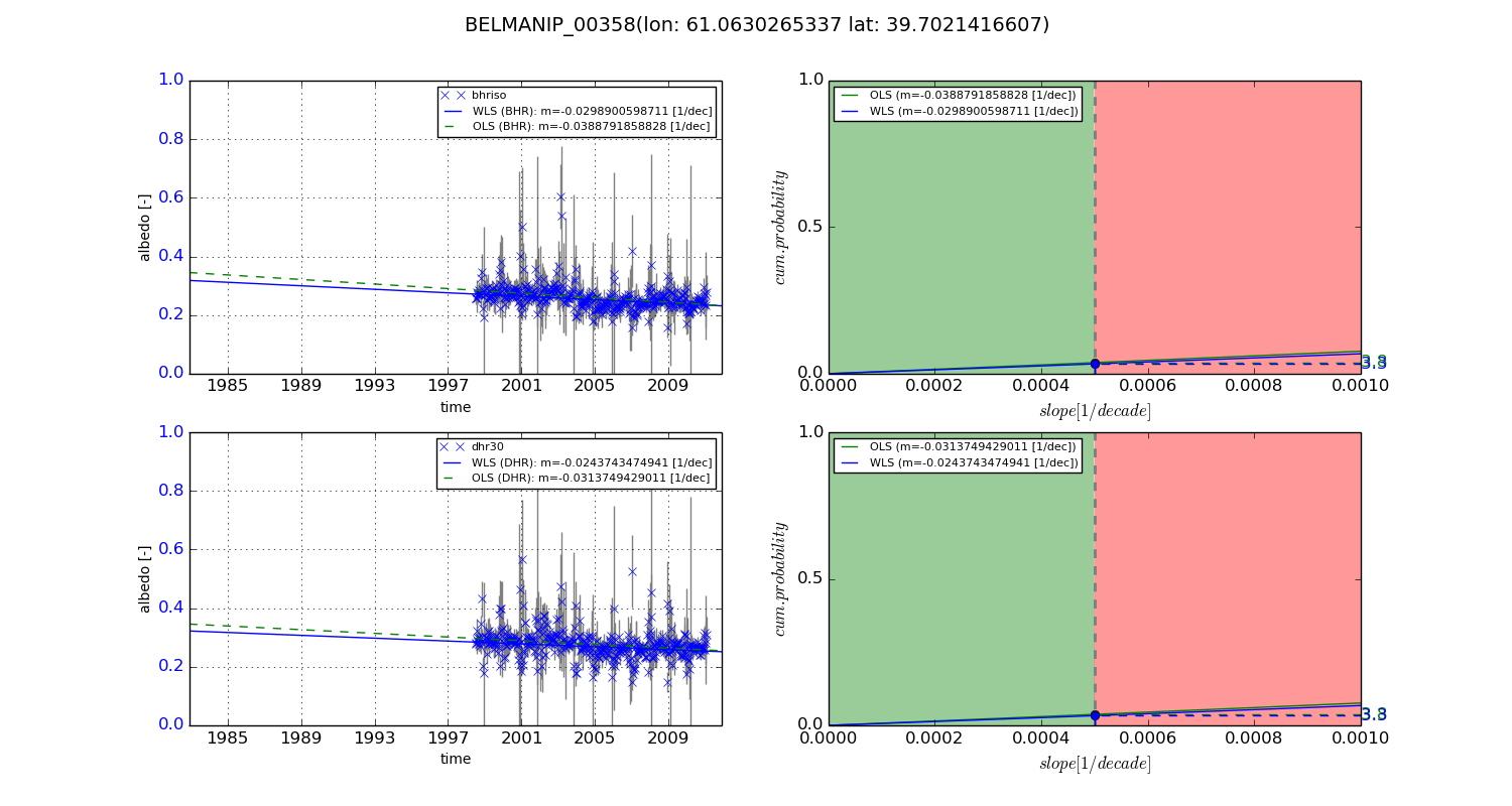
Temporal stability analysis

+000 deg (BHR)


BHR statistics

Temporal stability [1/decade]:


abs

rel


Weighted least square:

-99999.0


Ordinary least square:

-99999.0


Probabilities that GCOS criteria is met:

Weighted least square:

-99999.0 %

Ordinary least square:

-99999.0 %


DHR statistics

Temporal stability [1/decade]:


abs

rel


Weighted least square:

-99999.0


Ordinary least square:

-99999.0


Probabilities that GCOS criteria is met:

Weighted least square:

-99999.0 %

Ordinary least square:

-99999.0 %


+057/+063 deg (BHR)


BHR statistics

Temporal stability [1/decade]:


abs

rel


Weighted least square:

-0.0298900598711


Ordinary least square:

-0.0388791858828


Probabilities that GCOS criteria is met:

Weighted least square:

3.3 %

Ordinary least square:

3.8 %


DHR statistics

Temporal stability [1/decade]:


abs

rel


Weighted least square:

-0.0243743474941


Ordinary least square:

-0.0313749429011


Probabilities that GCOS criteria is met:

Weighted least square:

3.3 %

Ordinary least square:

3.8 %


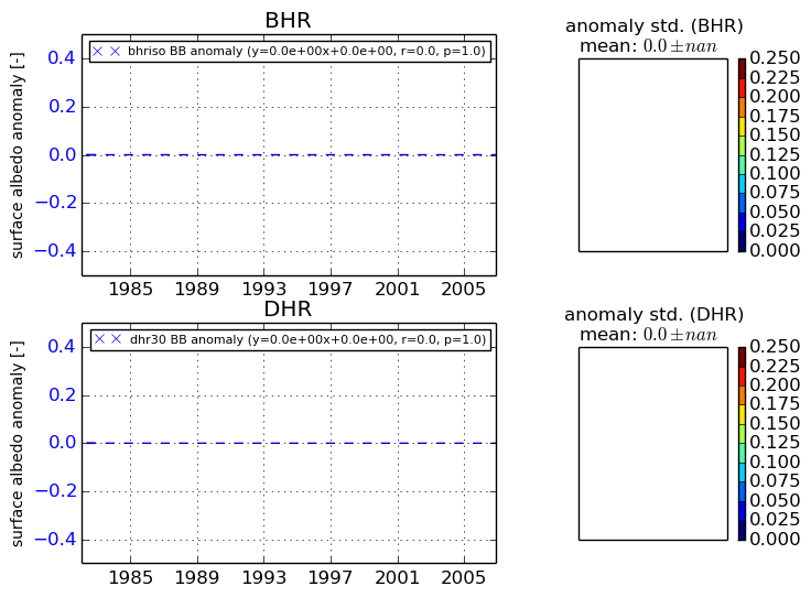
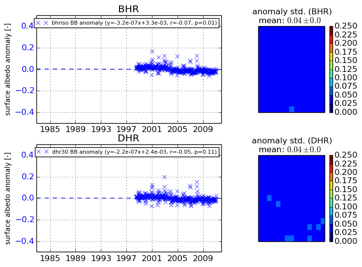
Temporal anomaly analyis

The variance of the temporal anomalies provides an additional measure about the stability of the signal AFTER removal of the mean seasonal cylce.
+000 deg


+057/+063 deg