DIRECT_00010


Location

lon / lat [deg]: 4.747 / 43.8115

Source network: DIRECT


Geostationary surface albedo (GSA) data


“+000”


“+057/+063”


Landcover information (based on ESA CCI landcover data)


Landcover fractions @ 2km distance


Landcover fractions @ 20 km distance


Legend


Distance to open water bodies [km]:

4.6

Distance to urban areas [km]:

2.57


Radius: 1 km

Number of landcover classes:

3

Dominant landcover type:

10: cropland, rainfed

Fraction of dominant landcover type [%]:

62.0


Radius: 2 km

Number of landcover classes:

4

Dominant landcover type:

10: cropland, rainfed

Fraction of dominant landcover type [%]:

78.0


Radius: 5 km

Number of landcover classes:

6

Dominant landcover type:

10: cropland, rainfed

Fraction of dominant landcover type [%]:

70.0


Radius: 10 km

Number of landcover classes:

8

Dominant landcover type:

10: cropland, rainfed

Fraction of dominant landcover type [%]:

51.0


Radius: 20 km

Number of landcover classes:

9

Dominant landcover type:

10: cropland, rainfed

Fraction of dominant landcover type [%]:

38.0


Disturbances


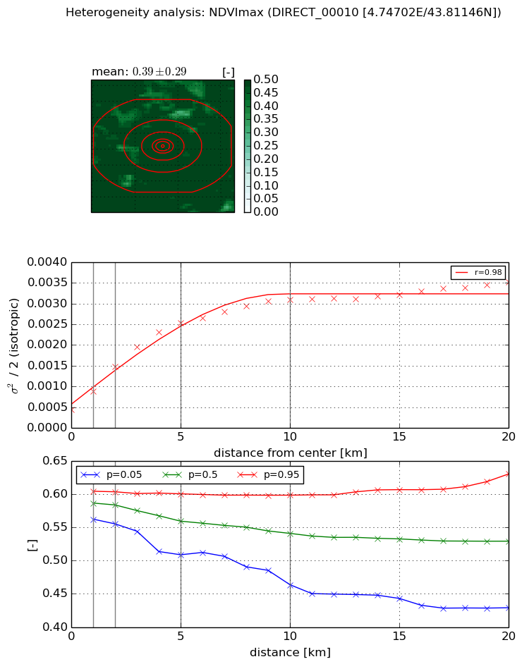
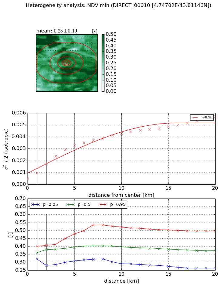
Heterogeneity analysis

The heterogeneity analysis provides information about the spatial and temporal heterogeneity of the site.

Topography


Roman et al. (2009) index


St

nan

Rcv

nan

Rse

nan

Rst

nan

Rsv

nan


Height range @ 1km [m]

4

Height range @ 2km [m]

4

Height range @ 5km [m]

84

Height range @ 10km [m]

-999

Height range @ 20km [m]

-999


Variance slope @ 1 km

275

Variance slope @ 2 km

378

Variance slope @ 5 km

398

Variance slope @ 10 km

-999

Variance slope @ 20 km

-999


NDVI (max. NDVI composite)


Roman et al. (2009) index


St

3.19456735552

Rcv

0.569589657598

Rse

0.0

Rst

-0.0825376324299

Rsv

0.286967011682


NDVI range @ 1km [-]

0.04

NDVI range @ 2km [-]

0.05

NDVI range @ 5km [-]

0.09

NDVI range @ 10km [-]

0.13

NDVI range @ 20km [-]

0.2


Variance slope @ 1 km

0.00045067959029

Variance slope @ 2 km

0.000520770412753

Variance slope @ 5 km

0.000435455460178

Variance slope @ 10 km

0.00025823051136

Variance slope @ 20 km

0.000119247981793


NDVI (min. NDVI composite)I


Roman et al. (2009) index


St

6.30808369343

Rcv

0.0526795504475

Rse

0.0

Rst

0.102929914184

Rsv

-0.319970782207


NDVI range @ 1km [-]

0.08

NDVI range @ 2km [-]

0.13

NDVI range @ 5km [-]

0.17

NDVI range @ 10km [-]

0.23

NDVI range @ 20km [-]

0.23


NDVI slope @ 1 km

0.00051115676695

NDVI slope @ 2 km

0.000621191700307

NDVI slope @ 5 km

0.000587329822642

NDVI slope @ 10 km

0.000376814822176

NDVI slope @ 20 km

0.000221604390911


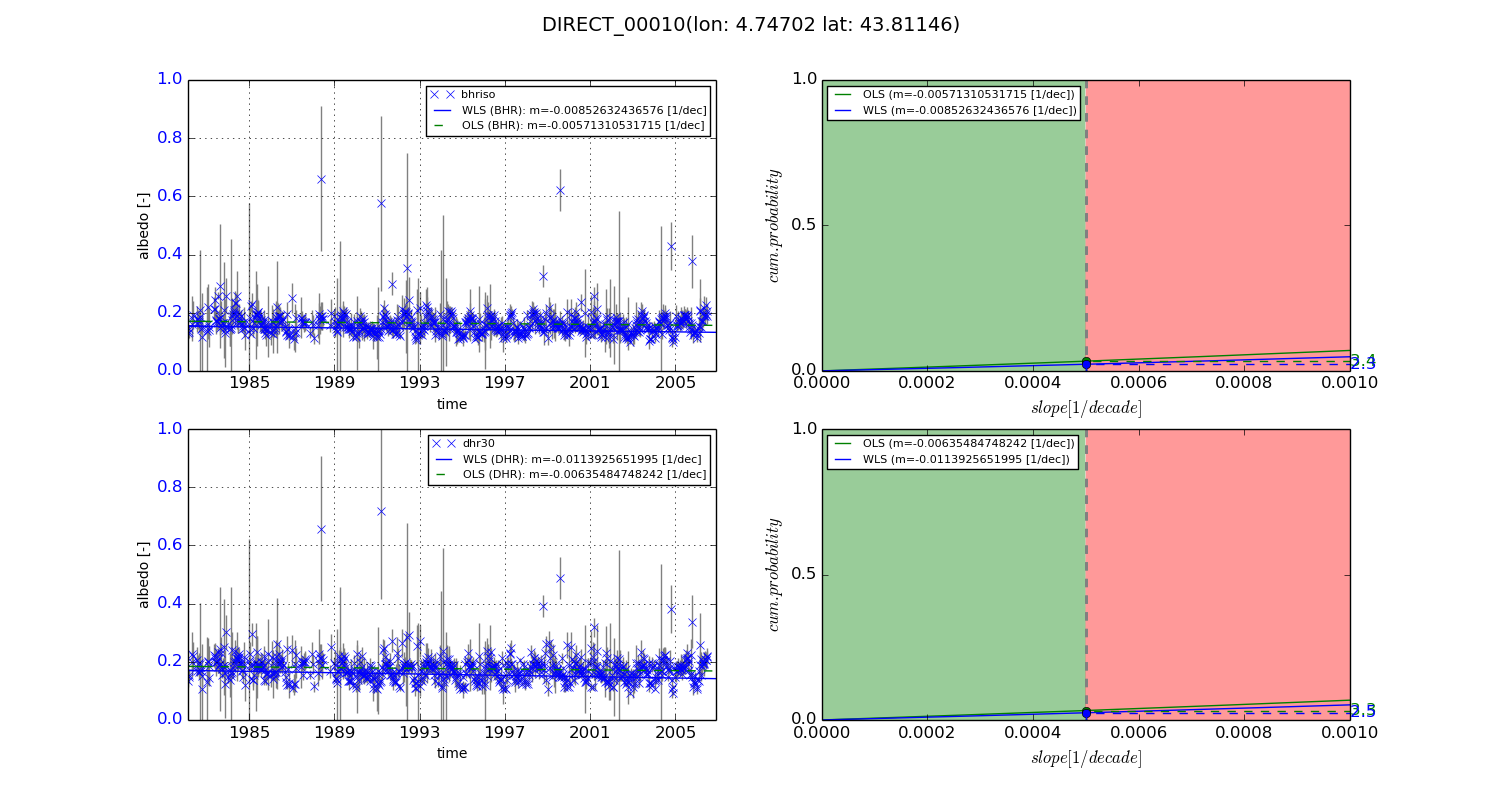
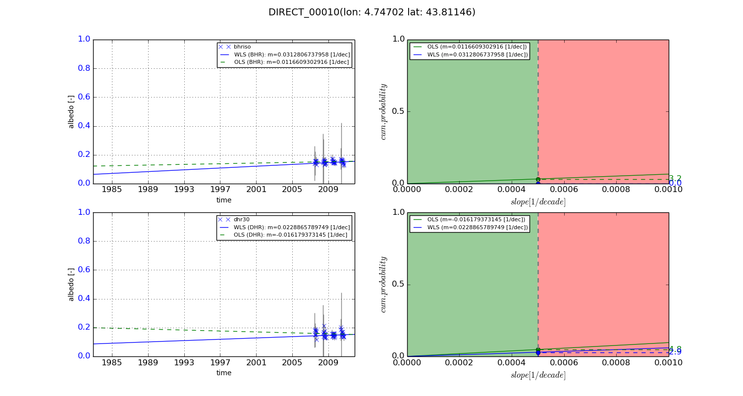
Temporal stability analysis

+000 deg (BHR)


BHR statistics

Temporal stability [1/decade]:


abs

rel


Weighted least square:

-0.00852632436576


Ordinary least square:

-0.00571310531715


Probabilities that GCOS criteria is met:

Weighted least square:

2.3 %

Ordinary least square:

3.4 %


DHR statistics

Temporal stability [1/decade]:


abs

rel


Weighted least square:

-0.0113925651995


Ordinary least square:

-0.00635484748242


Probabilities that GCOS criteria is met:

Weighted least square:

2.5 %

Ordinary least square:

3.3 %


+057/+063 deg (BHR)


BHR statistics

Temporal stability [1/decade]:


abs

rel


Weighted least square:

0.0312806737958


Ordinary least square:

0.0116609302916


Probabilities that GCOS criteria is met:

Weighted least square:

0.0 %

Ordinary least square:

3.2 %


DHR statistics

Temporal stability [1/decade]:


abs

rel


Weighted least square:

0.0228865789749


Ordinary least square:

-0.016179373145


Probabilities that GCOS criteria is met:

Weighted least square:

2.9 %

Ordinary least square:

4.8 %


Temporal anomaly analyis

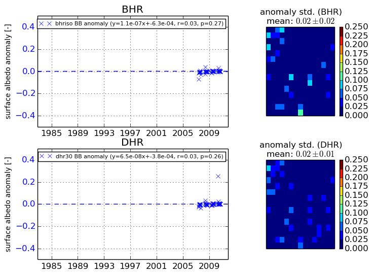
The variance of the temporal anomalies provides an additional measure about the stability of the signal AFTER removal of the mean seasonal cylce.
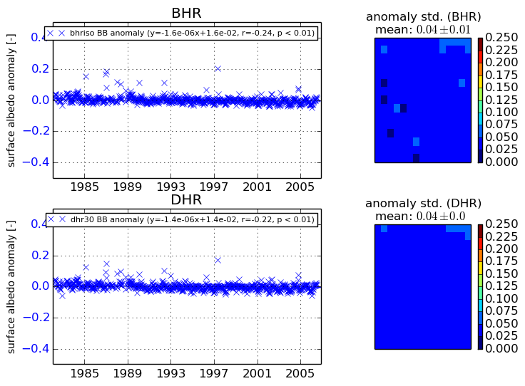
+000 deg


+057/+063 deg