DRAGON_LAREL


Location

lon / lat [deg]: -76.855 / 39.0808

Source network: AERONET


Geostationary surface albedo (GSA) data


“+000”


“+057/+063”


Landcover information (based on ESA CCI landcover data)


Landcover fractions @ 2km distance


Landcover fractions @ 20 km distance


Legend


Distance to open water bodies [km]:

2.61

Distance to urban areas [km]:

0.15


Radius: 1 km

Number of landcover classes:

1

Dominant landcover type:

190: urban areas

Fraction of dominant landcover type [%]:

100.0


Radius: 2 km

Number of landcover classes:

3

Dominant landcover type:

190: urban areas

Fraction of dominant landcover type [%]:

93.0


Radius: 5 km

Number of landcover classes:

7

Dominant landcover type:

190: urban areas

Fraction of dominant landcover type [%]:

72.0


Radius: 10 km

Number of landcover classes:

7

Dominant landcover type:

190: urban areas

Fraction of dominant landcover type [%]:

57.0


Radius: 20 km

Number of landcover classes:

5

Dominant landcover type:

190: urban areas

Fraction of dominant landcover type [%]:

63.0


Disturbances


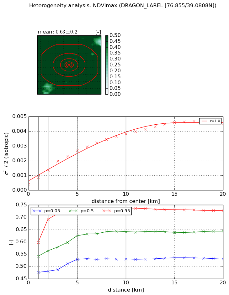
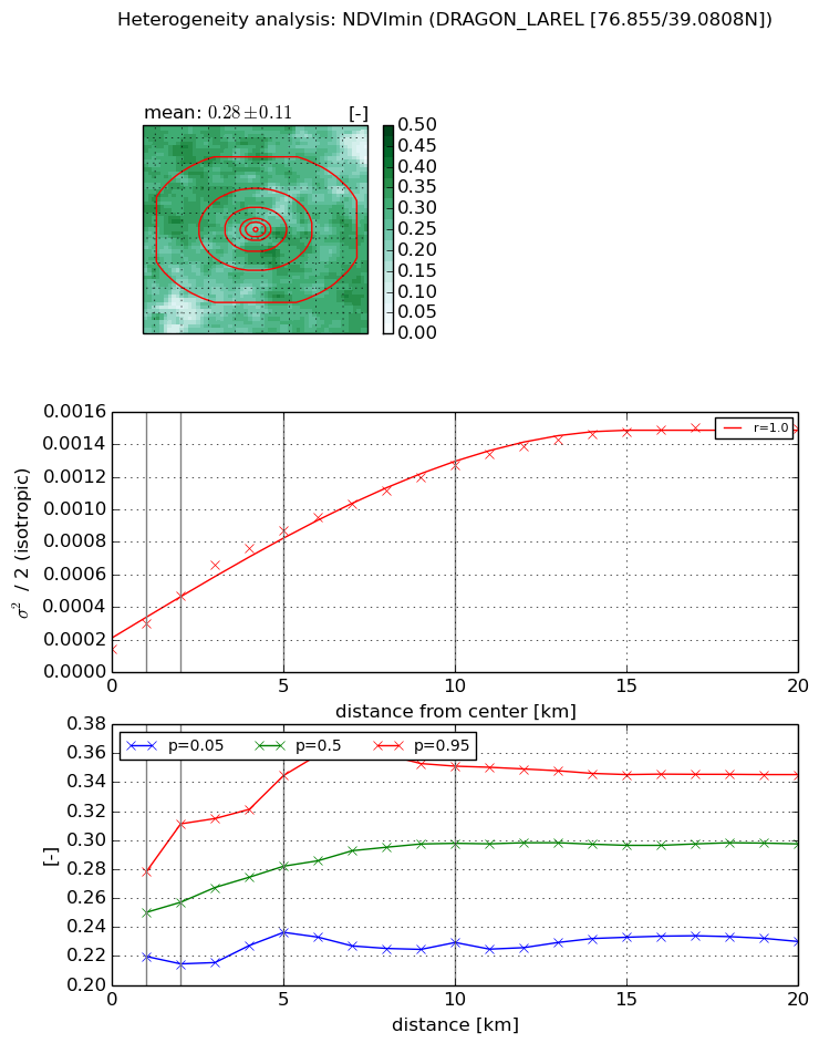
Heterogeneity analysis

The heterogeneity analysis provides information about the spatial and temporal heterogeneity of the site.

Topography


Roman et al. (2009) index


St

0.000902421101969

Rcv

0.127438748908

Rse

0.0

Rst

0.0311551512193

Rsv

3324.23175275


Height range @ 1km [m]

25

Height range @ 2km [m]

40

Height range @ 5km [m]

64

Height range @ 10km [m]

-999

Height range @ 20km [m]

-999


Variance slope @ 1 km

82

Variance slope @ 2 km

87

Variance slope @ 5 km

94

Variance slope @ 10 km

-999

Variance slope @ 20 km

-999


NDVI (max. NDVI composite)


Roman et al. (2009) index


St

5.42077851978

Rcv

-0.0588335889051

Rse

0.0

Rst

-0.104263728822

Rsv

0.390328724133


NDVI range @ 1km [-]

0.12

NDVI range @ 2km [-]

0.21

NDVI range @ 5km [-]

0.21

NDVI range @ 10km [-]

0.21

NDVI range @ 20km [-]

0.2


Variance slope @ 1 km

0.000451601585356

Variance slope @ 2 km

0.000478812219625

Variance slope @ 5 km

0.000471258497285

Variance slope @ 10 km

0.000342904839657

Variance slope @ 20 km

0.000201859263631


NDVI (min. NDVI composite)I


Roman et al. (2009) index


St

3.79605657774

Rcv

0.109733230334

Rse

0.0

Rst

-0.103730432114

Rsv

0.576830143389


NDVI range @ 1km [-]

0.06

NDVI range @ 2km [-]

0.1

NDVI range @ 5km [-]

0.11

NDVI range @ 10km [-]

0.12

NDVI range @ 20km [-]

0.12


NDVI slope @ 1 km

0.000156535770299

NDVI slope @ 2 km

0.000162339605094

NDVI slope @ 5 km

0.000149182042055

NDVI slope @ 10 km

0.000110283352407

NDVI slope @ 20 km

6.4768931431e-05


Temporal stability analysis

+000 deg (BHR)


BHR statistics

Temporal stability [1/decade]:


abs

rel


Weighted least square:

-99999.0


Ordinary least square:

-99999.0


Probabilities that GCOS criteria is met:

Weighted least square:

-99999.0 %

Ordinary least square:

-99999.0 %


DHR statistics

Temporal stability [1/decade]:


abs

rel


Weighted least square:

-99999.0


Ordinary least square:

-99999.0


Probabilities that GCOS criteria is met:

Weighted least square:

-99999.0 %

Ordinary least square:

-99999.0 %


+057/+063 deg (BHR)


BHR statistics

Temporal stability [1/decade]:


abs

rel


Weighted least square:

None


Ordinary least square:

None


Probabilities that GCOS criteria is met:

Weighted least square:

None %

Ordinary least square:

None %


DHR statistics

Temporal stability [1/decade]:


abs

rel


Weighted least square:

None


Ordinary least square:

None


Probabilities that GCOS criteria is met:

Weighted least square:

None %

Ordinary least square:

None %


Temporal anomaly analyis

The variance of the temporal anomalies provides an additional measure about the stability of the signal AFTER removal of the mean seasonal cylce.

+000 deg


+057/+063 deg