ETOSHA_PAN


Location

lon / lat [deg]: 15.9144 / -19.175

Source network: AERONET


Geostationary surface albedo (GSA) data


“+000”


“+057/+063”


Landcover information (based on ESA CCI landcover data)


Landcover fractions @ 2km distance


Landcover fractions @ 20 km distance


Legend


Distance to open water bodies [km]:

6.36

Distance to urban areas [km]:

none in region


Radius: 1 km

Number of landcover classes:

2

Dominant landcover type:

10: cropland, rainfed

Fraction of dominant landcover type [%]:

74.0


Radius: 2 km

Number of landcover classes:

2

Dominant landcover type:

10: cropland, rainfed

Fraction of dominant landcover type [%]:

70.0


Radius: 5 km

Number of landcover classes:

2

Dominant landcover type:

130: grassland

Fraction of dominant landcover type [%]:

65.0


Radius: 10 km

Number of landcover classes:

6

Dominant landcover type:

130: grassland

Fraction of dominant landcover type [%]:

72.0


Radius: 20 km

Number of landcover classes:

6

Dominant landcover type:

130: grassland

Fraction of dominant landcover type [%]:

72.0


Disturbances


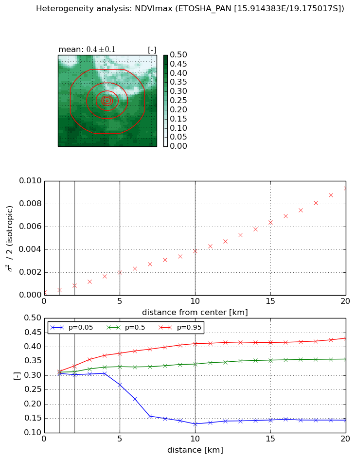
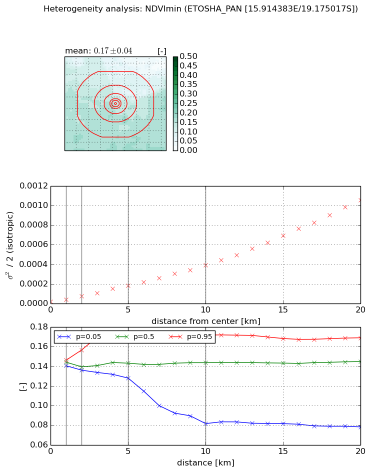
Heterogeneity analysis

The heterogeneity analysis provides information about the spatial and temporal heterogeneity of the site.

Topography


Roman et al. (2009) index


St

0.0137175268566

Rcv

0.537287824125

Rse

0.0

Rst

4.82297727082e-05

Rsv

218.160978254


Height range @ 1km [m]

6

Height range @ 2km [m]

10

Height range @ 5km [m]

23

Height range @ 10km [m]

-999

Height range @ 20km [m]

-999


Variance slope @ 1 km

2

Variance slope @ 2 km

4

Variance slope @ 5 km

10

Variance slope @ 10 km

-999

Variance slope @ 20 km

-999


NDVI (max. NDVI composite)


Roman et al. (2009) index


St

1.2967690419

Rcv

0.878872495131

Rse

0.0

Rst

-0.43456969128

Rsv

-0.99999983994


NDVI range @ 1km [-]

0.01

NDVI range @ 2km [-]

0.03

NDVI range @ 5km [-]

0.11

NDVI range @ 10km [-]

0.28

NDVI range @ 20km [-]

0.29


Variance slope @ 1 km

0.000212664332278

Variance slope @ 2 km

0.000310941115003

Variance slope @ 5 km

0.000365596247587

Variance slope @ 10 km

0.00036680327423

Variance slope @ 20 km

0.000449458038473


NDVI (min. NDVI composite)I


Roman et al. (2009) index


St

2.37412147124

Rcv

0.127686069581

Rse

0.0

Rst

0.0420957370652

Rsv

1.09384351175


NDVI range @ 1km [-]

0.01

NDVI range @ 2km [-]

0.02

NDVI range @ 5km [-]

0.04

NDVI range @ 10km [-]

0.09

NDVI range @ 20km [-]

0.09


NDVI slope @ 1 km

1.81249853655e-05

NDVI slope @ 2 km

2.70254963069e-05

NDVI slope @ 5 km

3.36530551355e-05

NDVI slope @ 10 km

3.7647694443e-05

NDVI slope @ 20 km

5.16589133091e-05


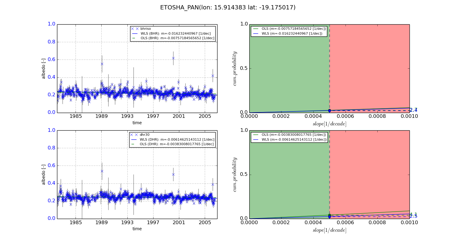
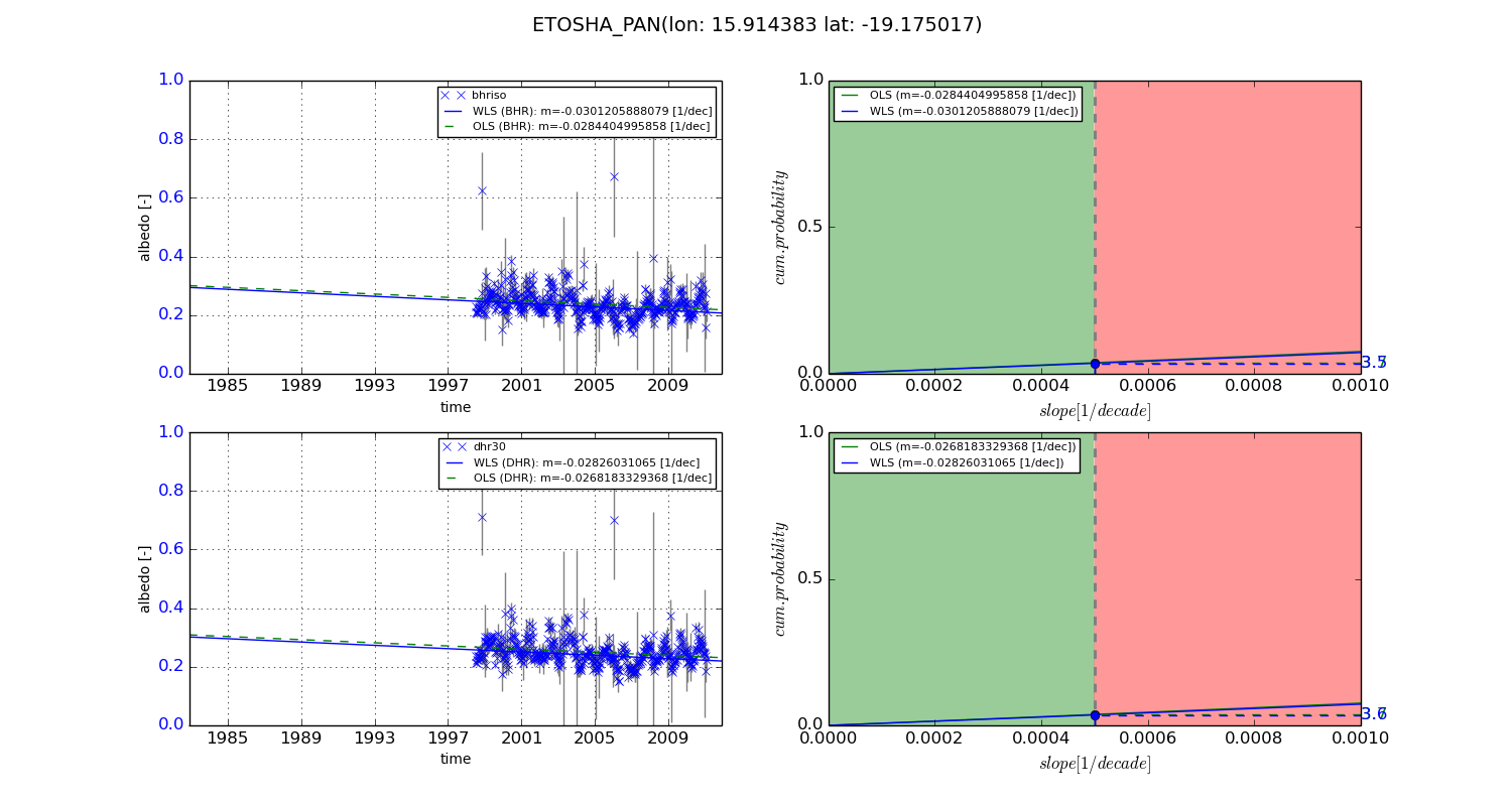
Temporal stability analysis

+000 deg (BHR)


BHR statistics

Temporal stability [1/decade]:


abs

rel


Weighted least square:

-0.016232440967


Ordinary least square:

-0.00757184565652


Probabilities that GCOS criteria is met:

Weighted least square:

2.4 %

Ordinary least square:

2.7 %


DHR statistics

Temporal stability [1/decade]:


abs

rel


Weighted least square:

-0.00614625143112


Ordinary least square:

-0.00383008017765


Probabilities that GCOS criteria is met:

Weighted least square:

2.5 %

Ordinary least square:

4.1 %


+057/+063 deg (BHR)


BHR statistics

Temporal stability [1/decade]:


abs

rel


Weighted least square:

-0.0301205888079


Ordinary least square:

-0.0284404995858


Probabilities that GCOS criteria is met:

Weighted least square:

3.5 %

Ordinary least square:

3.7 %


DHR statistics

Temporal stability [1/decade]:


abs

rel


Weighted least square:

-0.02826031065


Ordinary least square:

-0.0268183329368


Probabilities that GCOS criteria is met:

Weighted least square:

3.6 %

Ordinary least square:

3.7 %


Temporal anomaly analyis

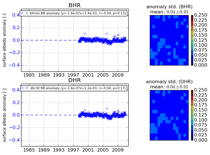
The variance of the temporal anomalies provides an additional measure about the stability of the signal AFTER removal of the mean seasonal cylce.
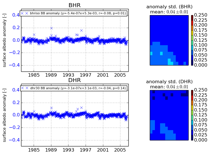
+000 deg


+057/+063 deg