GCR


Location

lon / lat [deg]: -89.87 / 34.25

Source network: BSRN


Geostationary surface albedo (GSA) data


“+000”


“+057/+063”


Landcover information (based on ESA CCI landcover data)


Landcover fractions @ 2km distance


Landcover fractions @ 20 km distance


Legend


Distance to open water bodies [km]:

6.84

Distance to urban areas [km]:

4.39


Radius: 1 km

Number of landcover classes:

5

Dominant landcover type:

130: grassland

Fraction of dominant landcover type [%]:

72.0


Radius: 2 km

Number of landcover classes:

7

Dominant landcover type:

130: grassland

Fraction of dominant landcover type [%]:

69.0


Radius: 5 km

Number of landcover classes:

7

Dominant landcover type:

130: grassland

Fraction of dominant landcover type [%]:

58.0


Radius: 10 km

Number of landcover classes:

10

Dominant landcover type:

130: grassland

Fraction of dominant landcover type [%]:

47.0


Radius: 20 km

Number of landcover classes:

10

Dominant landcover type:

130: grassland

Fraction of dominant landcover type [%]:

30.0


Disturbances


Heterogeneity analysis

The heterogeneity analysis provides information about the spatial and temporal heterogeneity of the site.

Topography


Roman et al. (2009) index


St

1.24805375824e-06

Rcv

0.290971222712

Rse

0.0

Rst

-0.133769430442

Rsv

2403742.18665


Height range @ 1km [m]

19

Height range @ 2km [m]

23

Height range @ 5km [m]

40

Height range @ 10km [m]

-999

Height range @ 20km [m]

-999


Variance slope @ 1 km

62

Variance slope @ 2 km

42

Variance slope @ 5 km

21

Variance slope @ 10 km

-999

Variance slope @ 20 km

-999


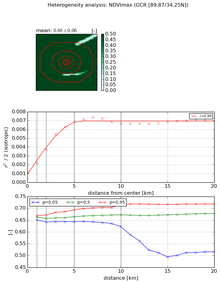
NDVI (max. NDVI composite)


Roman et al. (2009) index


St

6.938068745

Rcv

0.253778935568

Rse

0.0

Rst

0.0540738647465

Rsv

-0.124544183668


NDVI range @ 1km [-]

0.02

NDVI range @ 2km [-]

0.03

NDVI range @ 5km [-]

0.05

NDVI range @ 10km [-]

0.09

NDVI range @ 20km [-]

0.2


Variance slope @ 1 km

0.00110619724333

Variance slope @ 2 km

0.00129355331209

Variance slope @ 5 km

0.00121510264252

Variance slope @ 10 km

0.000558951950622

Variance slope @ 20 km

0.000183539419987


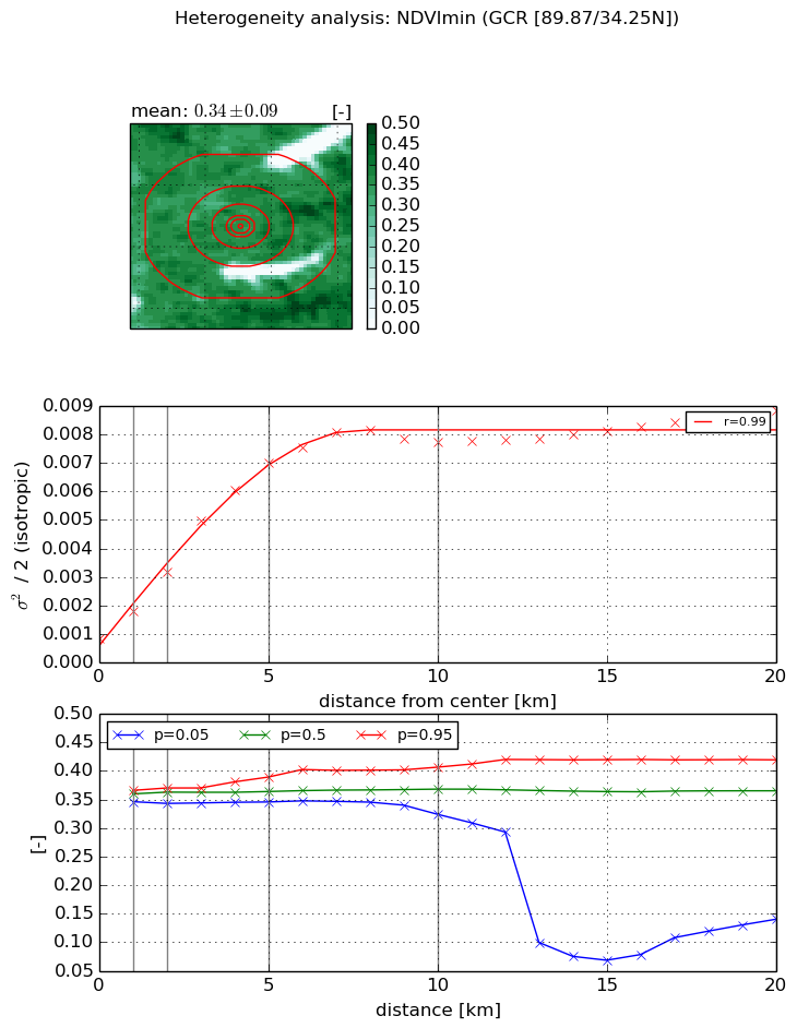
NDVI (min. NDVI composite)I


Roman et al. (2009) index


St

nan

Rcv

nan

Rse

nan

Rst

nan

Rsv

nan


NDVI range @ 1km [-]

0.02

NDVI range @ 2km [-]

0.03

NDVI range @ 5km [-]

0.04

NDVI range @ 10km [-]

0.08

NDVI range @ 20km [-]

0.28


NDVI slope @ 1 km

0.000950852398876

NDVI slope @ 2 km

0.00115186925118

NDVI slope @ 5 km

0.00129460387763

NDVI slope @ 10 km

0.000739234704039

NDVI slope @ 20 km

0.000295634290642


Temporal stability analysis

+000 deg (BHR)


BHR statistics

Temporal stability [1/decade]:


abs

rel


Weighted least square:

None


Ordinary least square:

None


Probabilities that GCOS criteria is met:

Weighted least square:

None %

Ordinary least square:

None %


DHR statistics

Temporal stability [1/decade]:


abs

rel


Weighted least square:

None


Ordinary least square:

None


Probabilities that GCOS criteria is met:

Weighted least square:

None %

Ordinary least square:

None %


+057/+063 deg (BHR)


BHR statistics

Temporal stability [1/decade]:


abs

rel


Weighted least square:

None


Ordinary least square:

None


Probabilities that GCOS criteria is met:

Weighted least square:

None %

Ordinary least square:

None %


DHR statistics

Temporal stability [1/decade]:


abs

rel


Weighted least square:

None


Ordinary least square:

None


Probabilities that GCOS criteria is met:

Weighted least square:

None %

Ordinary least square:

None %


Temporal anomaly analyis

The variance of the temporal anomalies provides an additional measure about the stability of the signal AFTER removal of the mean seasonal cylce.

+000 deg


+057/+063 deg