ISPRA


Location

lon / lat [deg]: 8.6267 / 45.803

Source network: AERONET


Geostationary surface albedo (GSA) data


“+000”


“+057/+063”


Landcover information (based on ESA CCI landcover data)


Landcover fractions @ 2km distance


Landcover fractions @ 20 km distance


Legend


Distance to open water bodies [km]:

1.71

Distance to urban areas [km]:

0.13


Radius: 1 km

Number of landcover classes:

3

Dominant landcover type:

190: urban areas

Fraction of dominant landcover type [%]:

48.0


Radius: 2 km

Number of landcover classes:

7

Dominant landcover type:

190: urban areas

Fraction of dominant landcover type [%]:

47.0


Radius: 5 km

Number of landcover classes:

8

Dominant landcover type:

190: urban areas

Fraction of dominant landcover type [%]:

26.0


Radius: 10 km

Number of landcover classes:

9

Dominant landcover type:

190: urban areas

Fraction of dominant landcover type [%]:

29.0


Radius: 20 km

Number of landcover classes:

7

Dominant landcover type:

60: Tree cover, broadleaved, decidous

Fraction of dominant landcover type [%]:

35.0


Disturbances


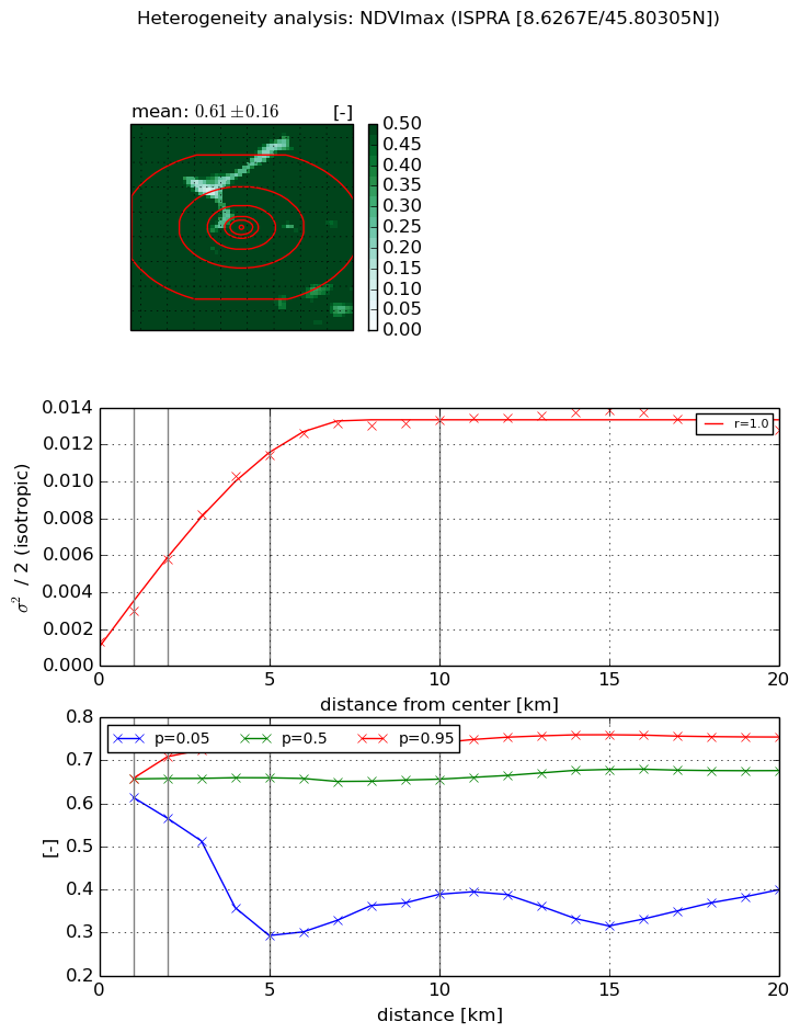
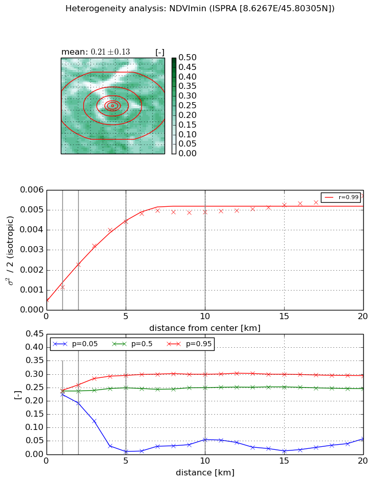
Heterogeneity analysis

The heterogeneity analysis provides information about the spatial and temporal heterogeneity of the site.

Topography


Roman et al. (2009) index


St

0.107402201526

Rcv

0.421805984529

Rse

0.0

Rst

-3.8159005061e-05

Rsv

27.5105441816


Height range @ 1km [m]

41

Height range @ 2km [m]

69

Height range @ 5km [m]

127

Height range @ 10km [m]

-999

Height range @ 20km [m]

-999


Variance slope @ 1 km

805

Variance slope @ 2 km

590

Variance slope @ 5 km

350

Variance slope @ 10 km

-999

Variance slope @ 20 km

-999


NDVI (max. NDVI composite)


Roman et al. (2009) index


St

1.19959836599e-06

Rcv

0.820168935599

Rse

0.0

Rst

0.101359928196

Rsv

2500836.09614


NDVI range @ 1km [-]

0.04

NDVI range @ 2km [-]

0.14

NDVI range @ 5km [-]

0.44

NDVI range @ 10km [-]

0.35

NDVI range @ 20km [-]

0.36


Variance slope @ 1 km

0.00167318192442

Variance slope @ 2 km

0.00223573390237

Variance slope @ 5 km

0.00213614517015

Variance slope @ 10 km

0.00122167384872

Variance slope @ 20 km

0.000439964786411


NDVI (min. NDVI composite)I


Roman et al. (2009) index


St

0.856064586828

Rcv

0.875268973293

Rse

0.0

Rst

-7.8039730971e-09

Rsv

2.62913950181


NDVI range @ 1km [-]

0.02

NDVI range @ 2km [-]

0.07

NDVI range @ 5km [-]

0.28

NDVI range @ 10km [-]

0.24

NDVI range @ 20km [-]

0.24


NDVI slope @ 1 km

0.000642030714527

NDVI slope @ 2 km

0.000876683378334

NDVI slope @ 5 km

0.000827015692199

NDVI slope @ 10 km

0.000445932876677

NDVI slope @ 20 km

0.000191014252796


Temporal stability analysis

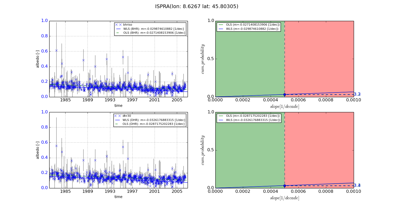
+000 deg (BHR)


BHR statistics

Temporal stability [1/decade]:


abs

rel


Weighted least square:

-0.029874610882


Ordinary least square:

-0.0271408153906


Probabilities that GCOS criteria is met:

Weighted least square:

3.3 %

Ordinary least square:

3.2 %


DHR statistics

Temporal stability [1/decade]:


abs

rel


Weighted least square:

-0.0326176883315


Ordinary least square:

-0.0287175202283


Probabilities that GCOS criteria is met:

Weighted least square:

3.4 %

Ordinary least square:

3.3 %


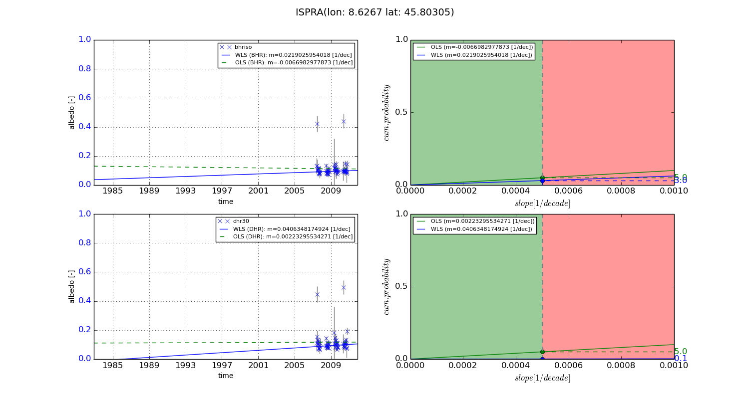
+057/+063 deg (BHR)


BHR statistics

Temporal stability [1/decade]:


abs

rel


Weighted least square:

0.0219025954018


Ordinary least square:

-0.0066982977873


Probabilities that GCOS criteria is met:

Weighted least square:

3.0 %

Ordinary least square:

5.0 %


DHR statistics

Temporal stability [1/decade]:


abs

rel


Weighted least square:

0.0406348174924


Ordinary least square:

0.00223295534271


Probabilities that GCOS criteria is met:

Weighted least square:

0.1 %

Ordinary least square:

5.0 %


Temporal anomaly analyis

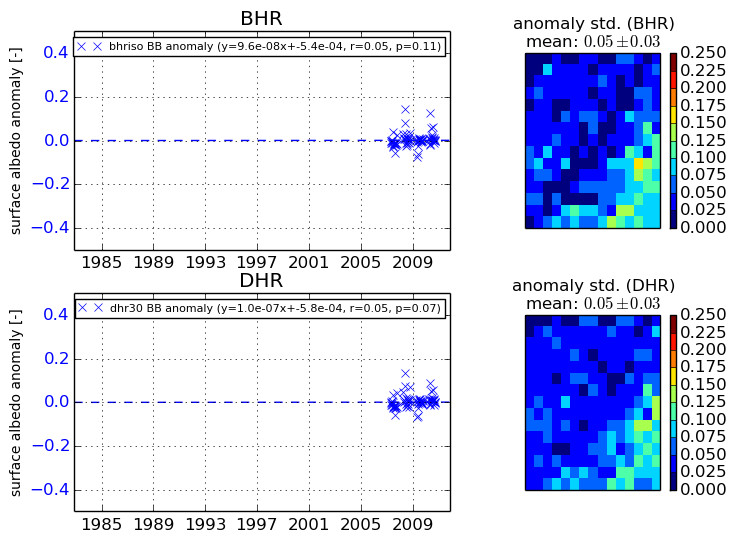
The variance of the temporal anomalies provides an additional measure about the stability of the signal AFTER removal of the mean seasonal cylce.
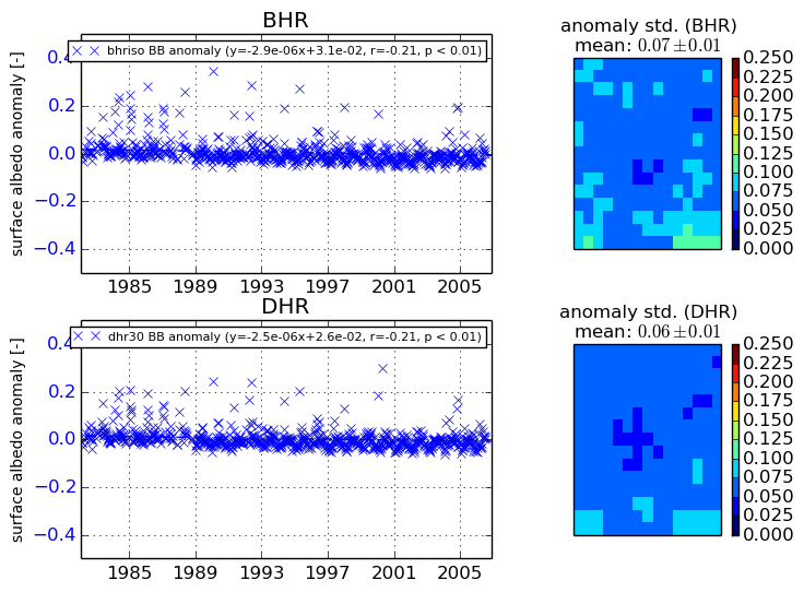
+000 deg


+057/+063 deg