KELLOGG_BIOLOGICAL_STATION_LTER_KBS


Location

lon / lat [deg]: -85.4 / 42.4

Source network: LTER


Geostationary surface albedo (GSA) data


“+000”


“+057/+063”


Landcover information (based on ESA CCI landcover data)


Landcover fractions @ 2km distance


Landcover fractions @ 20 km distance


Legend


Distance to open water bodies [km]:

0.19

Distance to urban areas [km]:

0.48


Radius: 1 km

Number of landcover classes:

5

Dominant landcover type:

210: water bodies

Fraction of dominant landcover type [%]:

59.0


Radius: 2 km

Number of landcover classes:

8

Dominant landcover type:

210: water bodies

Fraction of dominant landcover type [%]:

53.0


Radius: 5 km

Number of landcover classes:

11

Dominant landcover type:

10: cropland, rainfed

Fraction of dominant landcover type [%]:

41.0


Radius: 10 km

Number of landcover classes:

9

Dominant landcover type:

10: cropland, rainfed

Fraction of dominant landcover type [%]:

49.0


Radius: 20 km

Number of landcover classes:

9

Dominant landcover type:

10: cropland, rainfed

Fraction of dominant landcover type [%]:

41.0


Disturbances


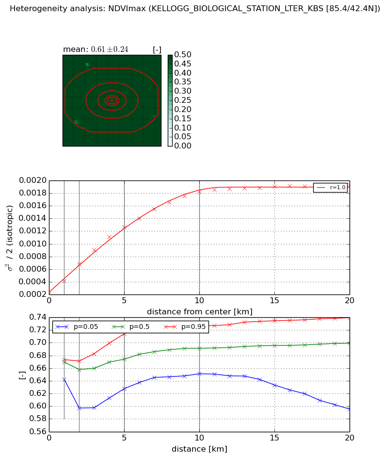
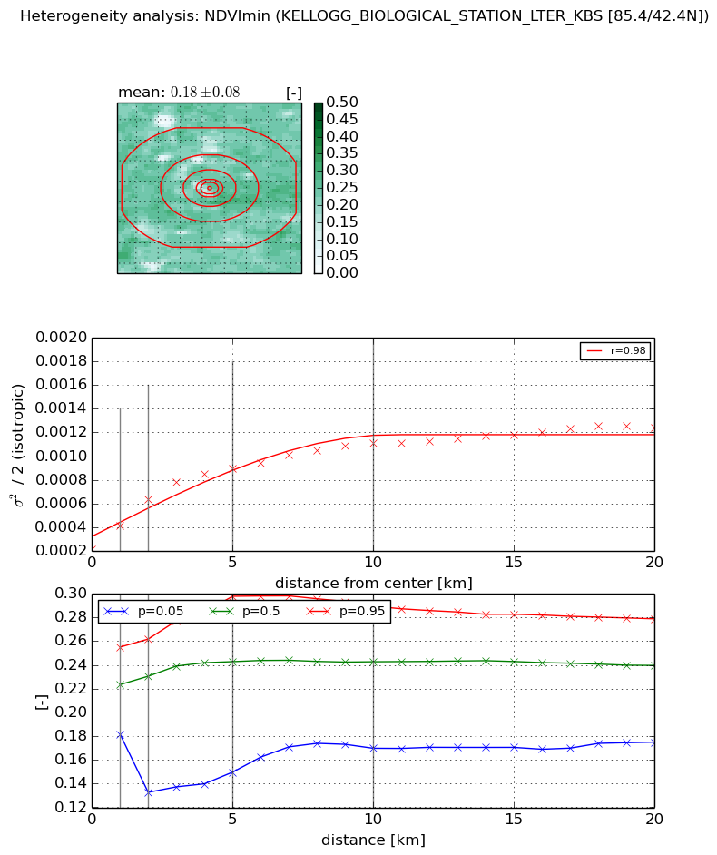
Heterogeneity analysis

The heterogeneity analysis provides information about the spatial and temporal heterogeneity of the site.

Topography


Roman et al. (2009) index


St

8.40808987351

Rcv

0.0117956496063

Rse

0.0

Rst

-0.119049732387

Rsv

0.225953848882


Height range @ 1km [m]

25

Height range @ 2km [m]

26

Height range @ 5km [m]

28

Height range @ 10km [m]

-999

Height range @ 20km [m]

-999


Variance slope @ 1 km

45

Variance slope @ 2 km

28

Variance slope @ 5 km

13

Variance slope @ 10 km

-999

Variance slope @ 20 km

-999


NDVI (max. NDVI composite)


Roman et al. (2009) index


St

18.1746598247

Rcv

0.0253867625417

Rse

0.0

Rst

-0.0445276029396

Rsv

0.0951506221959


NDVI range @ 1km [-]

0.03

NDVI range @ 2km [-]

0.07

NDVI range @ 5km [-]

0.09

NDVI range @ 10km [-]

0.08

NDVI range @ 20km [-]

0.14


Variance slope @ 1 km

0.000202630723432

Variance slope @ 2 km

0.000235178423799

Variance slope @ 5 km

0.000217464465302

Variance slope @ 10 km

0.000162966347583

Variance slope @ 20 km

7.68216308857e-05


NDVI (min. NDVI composite)I


Roman et al. (2009) index


St

8.77137326125

Rcv

-0.194310276741

Rse

0.0

Rst

0.075078866487

Rsv

-0.0726325574392


NDVI range @ 1km [-]

0.07

NDVI range @ 2km [-]

0.13

NDVI range @ 5km [-]

0.15

NDVI range @ 10km [-]

0.12

NDVI range @ 20km [-]

0.1


NDVI slope @ 1 km

0.000193080677336

NDVI slope @ 2 km

0.000207755219439

NDVI slope @ 5 km

0.000138261841587

NDVI slope @ 10 km

8.14861838133e-05

NDVI slope @ 20 km

4.02703372725e-05


Temporal stability analysis

+000 deg (BHR)


BHR statistics

Temporal stability [1/decade]:


abs

rel


Weighted least square:

None


Ordinary least square:

None


Probabilities that GCOS criteria is met:

Weighted least square:

None %

Ordinary least square:

None %


DHR statistics

Temporal stability [1/decade]:


abs

rel


Weighted least square:

None


Ordinary least square:

None


Probabilities that GCOS criteria is met:

Weighted least square:

None %

Ordinary least square:

None %


+057/+063 deg (BHR)


BHR statistics

Temporal stability [1/decade]:


abs

rel


Weighted least square:

None


Ordinary least square:

None


Probabilities that GCOS criteria is met:

Weighted least square:

None %

Ordinary least square:

None %


DHR statistics

Temporal stability [1/decade]:


abs

rel


Weighted least square:

None


Ordinary least square:

None


Probabilities that GCOS criteria is met:

Weighted least square:

None %

Ordinary least square:

None %


Temporal anomaly analyis

The variance of the temporal anomalies provides an additional measure about the stability of the signal AFTER removal of the mean seasonal cylce.

+000 deg


+057/+063 deg