NDOLA


Location

lon / lat [deg]: 28.6583 / -12.995

Source network: AERONET


Geostationary surface albedo (GSA) data


“+000”


“+057/+063”


Landcover information (based on ESA CCI landcover data)


Landcover fractions @ 2km distance


Landcover fractions @ 20 km distance


Legend


Distance to open water bodies [km]:

2.39

Distance to urban areas [km]:

0.18


Radius: 1 km

Number of landcover classes:

1

Dominant landcover type:

190: urban areas

Fraction of dominant landcover type [%]:

100.0


Radius: 2 km

Number of landcover classes:

1

Dominant landcover type:

190: urban areas

Fraction of dominant landcover type [%]:

100.0


Radius: 5 km

Number of landcover classes:

5

Dominant landcover type:

190: urban areas

Fraction of dominant landcover type [%]:

88.0


Radius: 10 km

Number of landcover classes:

8

Dominant landcover type:

10: cropland, rainfed

Fraction of dominant landcover type [%]:

44.0


Radius: 20 km

Number of landcover classes:

8

Dominant landcover type:

10: cropland, rainfed

Fraction of dominant landcover type [%]:

51.0


Disturbances


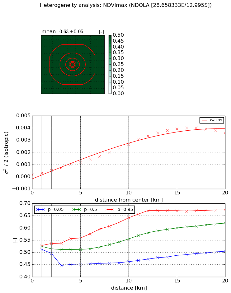
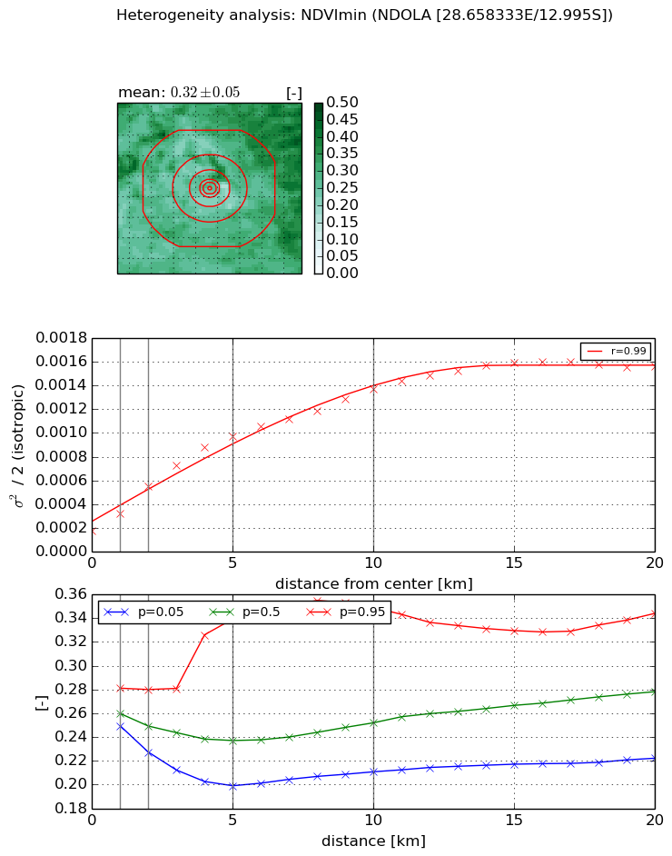
Heterogeneity analysis

The heterogeneity analysis provides information about the spatial and temporal heterogeneity of the site.

Topography


Roman et al. (2009) index


St

0.923591894289

Rcv

0.582135780042

Rse

0.0

Rst

2.07592316446e-06

Rsv

2.66605002718


Height range @ 1km [m]

13

Height range @ 2km [m]

40

Height range @ 5km [m]

81

Height range @ 10km [m]

-999

Height range @ 20km [m]

-999


Variance slope @ 1 km

112

Variance slope @ 2 km

148

Variance slope @ 5 km

188

Variance slope @ 10 km

-999

Variance slope @ 20 km

-999


NDVI (max. NDVI composite)


Roman et al. (2009) index


St

1.72684843662e-07

Rcv

0.221062003465

Rse

0.0

Rst

0.721135281858

Rsv

17372687.5717


NDVI range @ 1km [-]

0.02

NDVI range @ 2km [-]

0.04

NDVI range @ 5km [-]

0.11

NDVI range @ 10km [-]

0.18

NDVI range @ 20km [-]

0.17


Variance slope @ 1 km

0.000136633796244

Variance slope @ 2 km

0.000186571131591

Variance slope @ 5 km

0.000215581471512

Variance slope @ 10 km

0.00024688511067

Variance slope @ 20 km

0.000215051836954


NDVI (min. NDVI composite)I


Roman et al. (2009) index


St

1.68766686516

Rcv

0.729422111735

Rse

0.0

Rst

-0.301379147213

Rsv

0.746800744104


NDVI range @ 1km [-]

0.03

NDVI range @ 2km [-]

0.05

NDVI range @ 5km [-]

0.14

NDVI range @ 10km [-]

0.14

NDVI range @ 20km [-]

0.12


NDVI slope @ 1 km

0.000150089535974

NDVI slope @ 2 km

0.000190290440427

NDVI slope @ 5 km

0.000166633416129

NDVI slope @ 10 km

0.000115154161515

NDVI slope @ 20 km

6.58103221094e-05


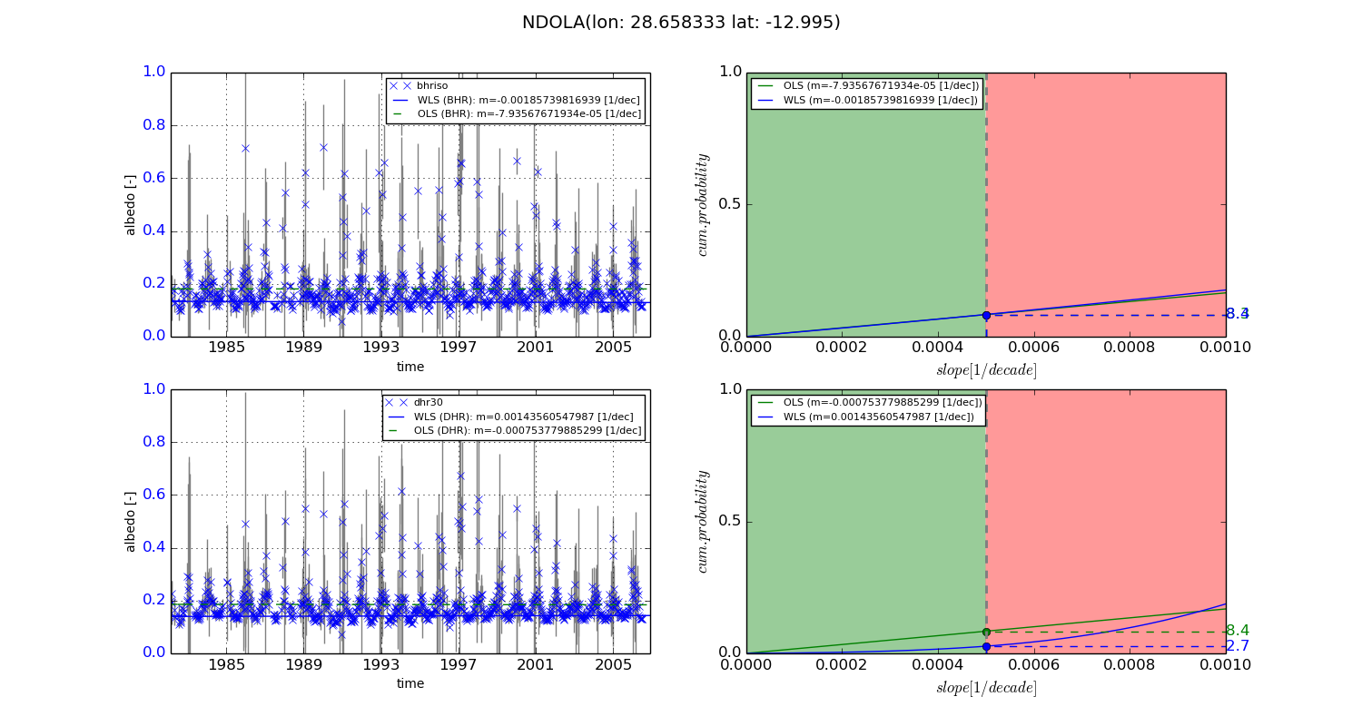
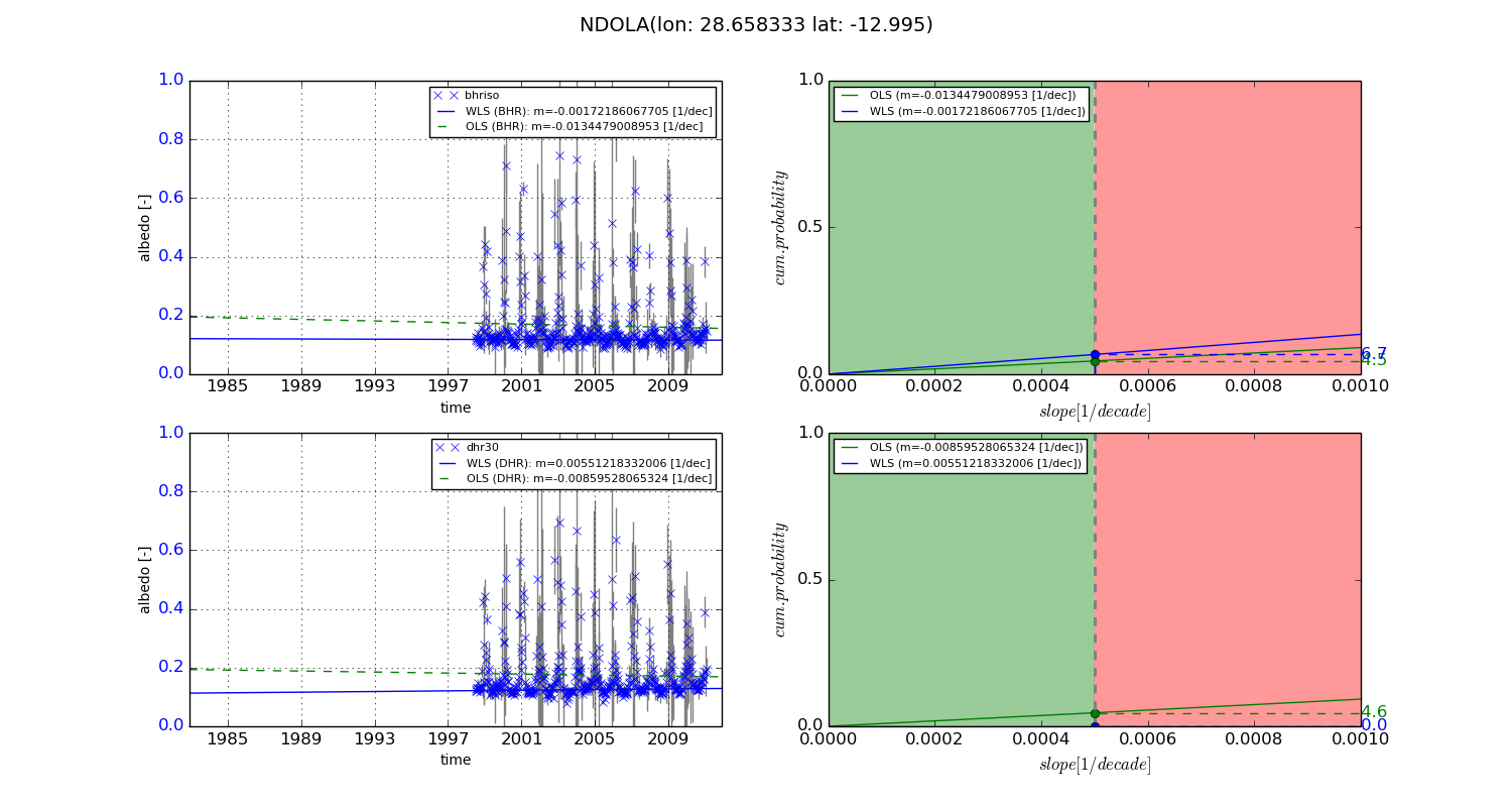
Temporal stability analysis

+000 deg (BHR)


BHR statistics

Temporal stability [1/decade]:


abs

rel


Weighted least square:

-0.00185739816939


Ordinary least square:

-7.93567671934e-05


Probabilities that GCOS criteria is met:

Weighted least square:

8.4 %

Ordinary least square:

8.3 %


DHR statistics

Temporal stability [1/decade]:


abs

rel


Weighted least square:

0.00143560547987


Ordinary least square:

-0.000753779885299


Probabilities that GCOS criteria is met:

Weighted least square:

2.7 %

Ordinary least square:

8.4 %


+057/+063 deg (BHR)


BHR statistics

Temporal stability [1/decade]:


abs

rel


Weighted least square:

-0.00172186067705


Ordinary least square:

-0.0134479008953


Probabilities that GCOS criteria is met:

Weighted least square:

6.7 %

Ordinary least square:

4.5 %


DHR statistics

Temporal stability [1/decade]:


abs

rel


Weighted least square:

0.00551218332006


Ordinary least square:

-0.00859528065324


Probabilities that GCOS criteria is met:

Weighted least square:

0.0 %

Ordinary least square:

4.6 %


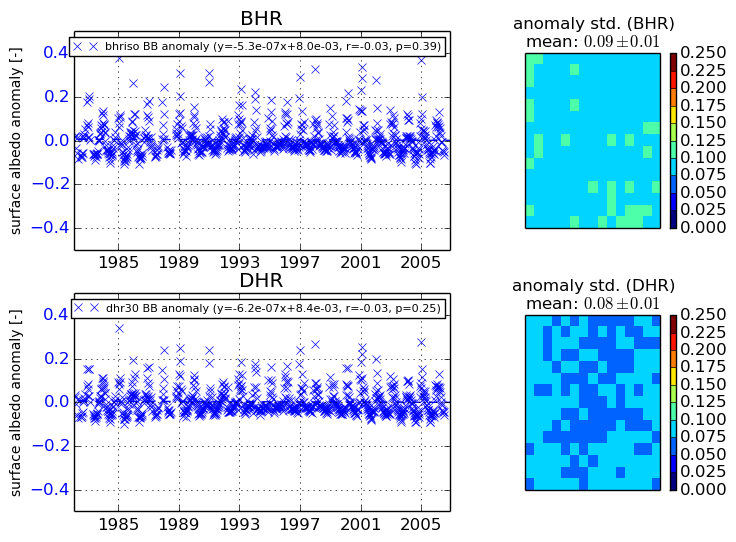
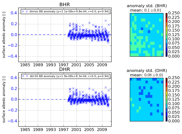
Temporal anomaly analyis

The variance of the temporal anomalies provides an additional measure about the stability of the signal AFTER removal of the mean seasonal cylce.
+000 deg


+057/+063 deg