NEGEV


Location

lon / lat [deg]: 35.01 / 30.11

Source network: CEOS_LANDNET


Geostationary surface albedo (GSA) data


“+000”


“+057/+063”


Landcover information (based on ESA CCI landcover data)


Landcover fractions @ 2km distance


Landcover fractions @ 20 km distance


Legend


Distance to open water bodies [km]:

43.44

Distance to urban areas [km]:

17.15


Radius: 1 km

Number of landcover classes:

1

Dominant landcover type:

200: bare areas

Fraction of dominant landcover type [%]:

100.0


Radius: 2 km

Number of landcover classes:

1

Dominant landcover type:

200: bare areas

Fraction of dominant landcover type [%]:

100.0


Radius: 5 km

Number of landcover classes:

1

Dominant landcover type:

200: bare areas

Fraction of dominant landcover type [%]:

100.0


Radius: 10 km

Number of landcover classes:

1

Dominant landcover type:

200: bare areas

Fraction of dominant landcover type [%]:

100.0


Radius: 20 km

Number of landcover classes:

1

Dominant landcover type:

200: bare areas

Fraction of dominant landcover type [%]:

99.0


Disturbances


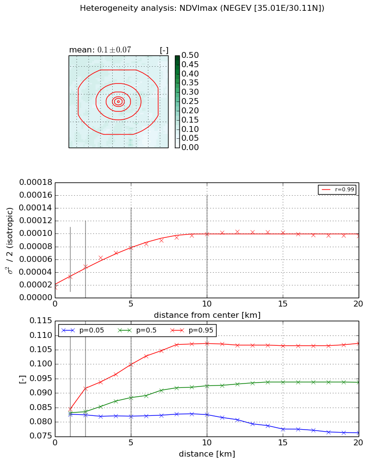
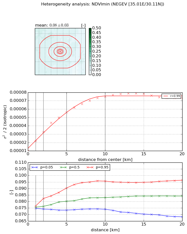
Heterogeneity analysis

The heterogeneity analysis provides information about the spatial and temporal heterogeneity of the site.

Topography


Roman et al. (2009) index


St

0.2667224008

Rcv

0.961980891338

Rse

0.0

Rst

6.65925976882e-06

Rsv

10.285661657


Height range @ 1km [m]

17

Height range @ 2km [m]

31

Height range @ 5km [m]

104

Height range @ 10km [m]

-999

Height range @ 20km [m]

-999


Variance slope @ 1 km

124

Variance slope @ 2 km

152

Variance slope @ 5 km

235

Variance slope @ 10 km

-999

Variance slope @ 20 km

-999


NDVI (max. NDVI composite)


Roman et al. (2009) index


St

1.12625893474

Rcv

0.383166917597

Rse

0.0

Rst

-0.44559951716

Rsv

1.83491942598


NDVI range @ 1km [-]

0.0

NDVI range @ 2km [-]

0.01

NDVI range @ 5km [-]

0.02

NDVI range @ 10km [-]

0.02

NDVI range @ 20km [-]

0.03


Variance slope @ 1 km

1.73177840627e-05

Variance slope @ 2 km

1.64128694004e-05

Variance slope @ 5 km

1.24139613834e-05

Variance slope @ 10 km

7.97711618527e-06

Variance slope @ 20 km

3.1699426161e-06


NDVI (min. NDVI composite)I


Roman et al. (2009) index


St

1.04677285523

Rcv

0.435487428491

Rse

0.0

Rst

-0.447914223555

Rsv

1.98254962382


NDVI range @ 1km [-]

0.0

NDVI range @ 2km [-]

0.01

NDVI range @ 5km [-]

0.02

NDVI range @ 10km [-]

0.02

NDVI range @ 20km [-]

0.03


NDVI slope @ 1 km

1.17859991981e-05

NDVI slope @ 2 km

1.13456495737e-05

NDVI slope @ 5 km

9.27398088126e-06

NDVI slope @ 10 km

6.36733966756e-06

NDVI slope @ 20 km

2.63165407335e-06


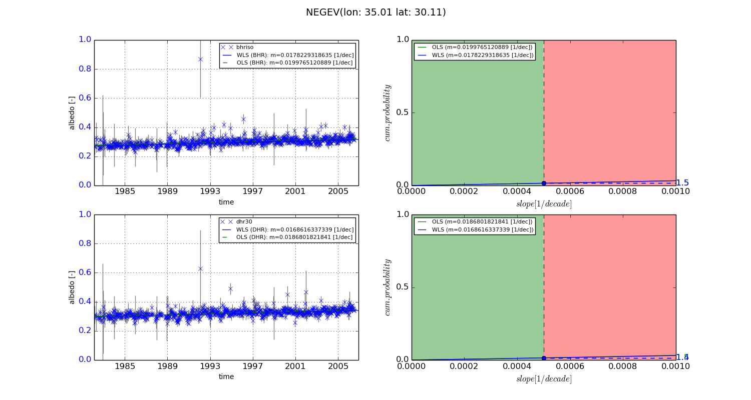
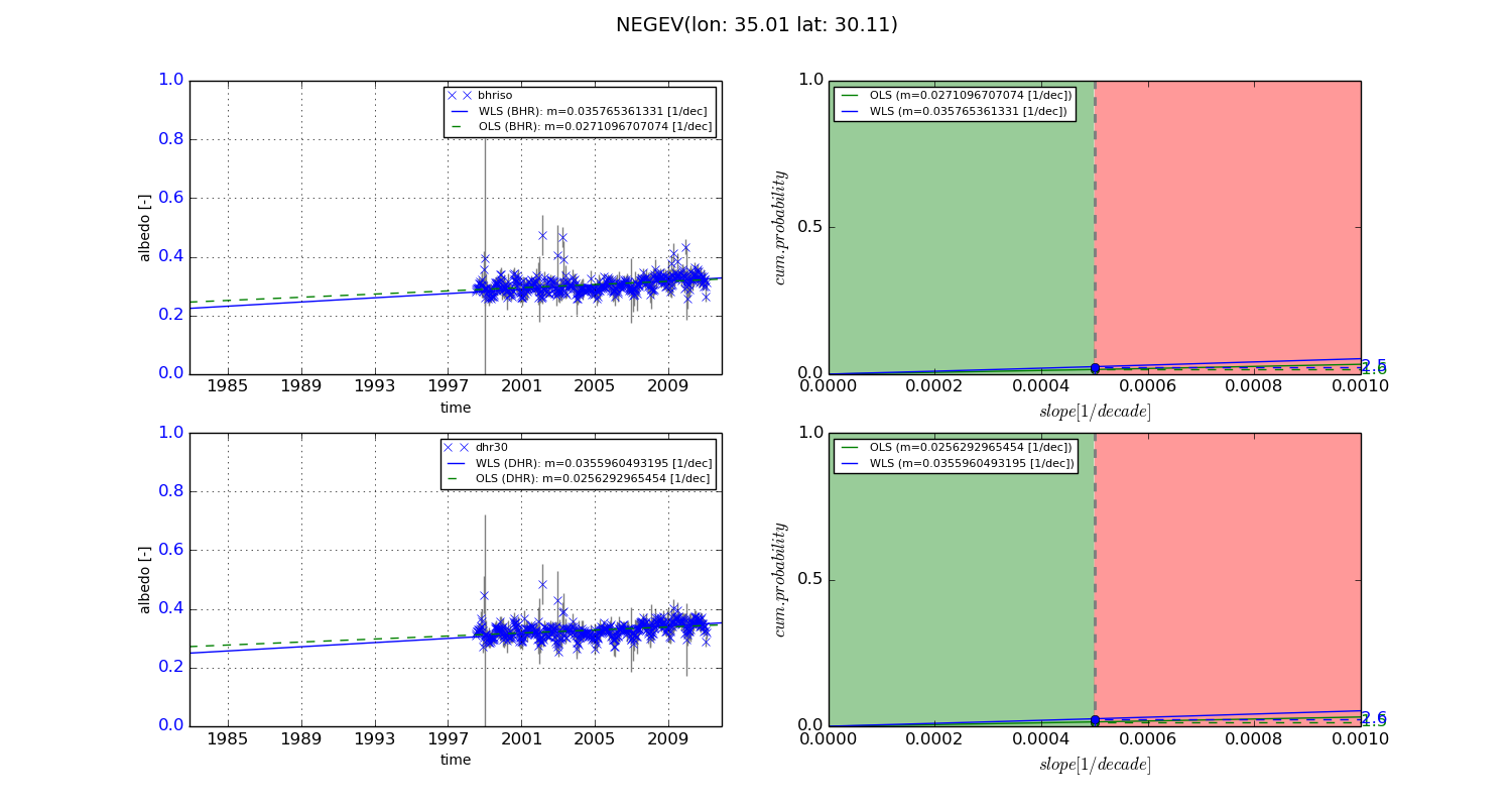
Temporal stability analysis

+000 deg (BHR)


BHR statistics

Temporal stability [1/decade]:


abs

rel


Weighted least square:

0.0178229318635


Ordinary least square:

0.0199765120889


Probabilities that GCOS criteria is met:

Weighted least square:

1.5 %

Ordinary least square:

1.5 %


DHR statistics

Temporal stability [1/decade]:


abs

rel


Weighted least square:

0.0168616337339


Ordinary least square:

0.0186801821841


Probabilities that GCOS criteria is met:

Weighted least square:

1.4 %

Ordinary least square:

1.5 %


+057/+063 deg (BHR)


BHR statistics

Temporal stability [1/decade]:


abs

rel


Weighted least square:

0.035765361331


Ordinary least square:

0.0271096707074


Probabilities that GCOS criteria is met:

Weighted least square:

2.5 %

Ordinary least square:

1.6 %


DHR statistics

Temporal stability [1/decade]:


abs

rel


Weighted least square:

0.0355960493195


Ordinary least square:

0.0256292965454


Probabilities that GCOS criteria is met:

Weighted least square:

2.6 %

Ordinary least square:

1.5 %


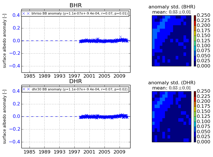
Temporal anomaly analyis

The variance of the temporal anomalies provides an additional measure about the stability of the signal AFTER removal of the mean seasonal cylce.
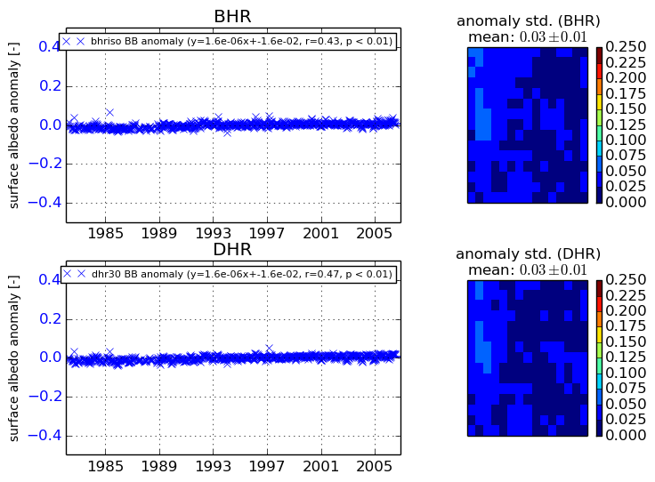
+000 deg


+057/+063 deg